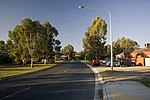
Tuggeranong
1966 establishments in AustraliaDistricts of the Australian Capital TerritoryPages with non-numeric formatnum argumentsUse Australian English from August 2012

Tuggeranong () is a district in the Australian Capital Territory in Australia. The district is subdivided into divisions (suburbs), sections and blocks and is the southernmost district of the Australian Capital Territory. The district comprises nineteen suburbs and occupies 117 square kilometres (45 sq mi) to the east of the Murrumbidgee River. The name Tuggeranong is derived from a Ngunnawal expression meaning "cold place". From the earliest colonial times, the plain extending south into the centre of the present-day territory was referred to as Tuggeranong. At the 2021 census, the population of the district was 89,461.
Excerpt from the Wikipedia article Tuggeranong (License: CC BY-SA 3.0, Authors, Images).Tuggeranong
Azalea Circuit,
Geographical coordinates (GPS) Address Nearby Places Show on map
Geographical coordinates (GPS)
| Latitude | Longitude |
|---|---|
| N -35.4244 ° | E 149.0888 ° |
Address
Azalea Circuit
2905 , Isabella Plains
Australia
Open on Google Maps


