place

RCAF Detachment Gananoque

1940 establishments in Ontario1945 disestablishments in OntarioAirports of the British Commonwealth Air Training PlanDefunct airports in OntarioMilitary airbases in Ontario
Military history of OntarioMilitary installations closed in 1945Royal Canadian Air Force stations
RCAF Gananoque Hangar 1

RCAF Detachment Gananoque was a relief landing field for the Royal Air Force's No. 31 Service Flying Training School (SFTS) located at RCAF Station Kingston during the Second World War. The airfield was located north of Gananoque, Ontario, Canada. Gananoque consisted of a triangle-shaped runway pattern, one hangar, and a control tower. Gananoque officially became a British Commonwealth Air Training Plan (BCATP) facility in 1942 when RAF training schools became part of the BCATP. The station opened in 1940 and closed in 1945. The airfield was constructed in a typical BCATP wartime pattern, with three runways formed in a triangle. In approximately 1942 the aerodrome was listed at 44°24′N 76°15′W with a variation of 12 degrees west and elevation of 395 ft (120 m). Three runways were listed as follows: Today, the former station is operated as the Gananoque Airport.

Excerpt from the Wikipedia article RCAF Detachment Gananoque (License: CC BY-SA 3.0, Authors, Images).

RCAF Detachment Gananoque
Pine Grove Road,

Geographical coordinates (GPS) Address Nearby Places
placeShow on map

Wikipedia: RCAF Detachment GananoqueContinue reading on Wikipedia

Geographical coordinates (GPS)

Latitude Longitude
N 44.401411 ° E -76.243315 °
placeShow on map

Address

Gananoque Airport

Pine Grove Road
K7G 2V3
Ontario, Canada
mapOpen on Google Maps

RCAF Gananoque Hangar 1
Share experience

Nearby Places

Frontenac Arch Biosphere Reserve

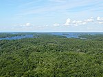
The Frontenac Arch Biosphere Reserve is a UNESCO Biosphere Reserve located in southeastern Ontario, Canada. The biosphere reserve was designated in 2002, and is one of 16 biosphere reserves in Canada. The Frontenac Arch Biosphere operates primarily within a 2,700 km2. region from Brockville to Kingston, extending north to Verona and Perth. The Frontenac Arch Biosphere is located in the Thousand Islands - Frontenac Arch area, in one of the great crossroads of Eastern Canada. An ancient granite bridge, called the Frontenac Arch, runs from the northern Canadian Shield in Algonquin Park to the Adirondack Mountains in the United States. The granite arch intersects with the St. Lawrence River in the southernmost part of the Frontenac Arch Biosphere boundary, as the St. Lawrence River runs southwest to northeast from Kingston to Brockville. The Biosphere Reserve operates as a not-for-profit network, called the Frontenac Arch Biosphere Network, with over 100 regional partners, and a suite of programs aimed at encouraging the community to become a global model for sustainable development. The Frontenac Arch Biosphere’s activities are guided by three core functions as set by UNESCO and the Man and the Biosphere Programme: Conservation: To contribute to the protection of cultural diversity and biodiversity through sharing of knowledge and best practices concerning the conservation of ecosystems, species and the natural biodiversity of the region. Sustainable Development: To foster and promote human development that is socially, culturally, economically and ecologically sustainable for all time. Capacity Building: To facilitate dialogue and information-sharing between communities, resource sectors, governments and researchers, for the purpose of education, training, research and/or monitoring projects.