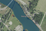
River Raisin
Incomplete lists from April 2015Michigan in the War of 1812Monroe, MichiganRivers of Hillsdale County, MichiganRivers of Jackson County, Michigan ... and 5 more
Rivers of Lenawee County, MichiganRivers of MichiganRivers of Monroe County, MichiganRivers of Washtenaw County, MichiganTributaries of Lake Erie

The River Raisin is a river in southeastern Michigan, United States, that flows through glacial sediments into Lake Erie. The area today is an agricultural and industrial center of Michigan. The river flows for almost 139 miles (224 km), draining an area of 1,072 square miles (2,780 km2) in the Michigan counties of Lenawee, Washtenaw, Jackson, Hillsdale, and Monroe County, where its mouth at Lake Erie is located. French settlers named it as La Rivière aux Raisins because of the wild grapes growing along its banks, the French word for grape being raisin. The French term for "raisin" is raisin sec (dry grape).
Excerpt from the Wikipedia article River Raisin (License: CC BY-SA 3.0, Authors, Images).River Raisin
Geographical coordinates (GPS) Address Nearby Places Show on map
Geographical coordinates (GPS)
| Latitude | Longitude |
|---|---|
| N 41.891944444444 ° | E -83.336666666667 ° |
Address
Michigan
Michigan, United States
Open on Google Maps


