place

Kauslers Island

Islands of Monroe County, MichiganSoutheast Michigan geography stubs
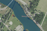
NASA Worldwind, USGS imagery map, Kauslers Island, Michigan

Kauslers Island is an island in Plum Creek, near Lake Erie. It is in Monroe County, Michigan. Its coordinates are 41°53′28″N 83°22′35″W, and the United States Geological Survey gives its elevation as 581 ft (177 m).

Excerpt from the Wikipedia article Kauslers Island (License: CC BY-SA 3.0, Authors, Images).

Kauslers Island
East Dunbar Road,

Geographical coordinates (GPS) Address Nearby Places
placeShow on map

Wikipedia: Kauslers IslandContinue reading on Wikipedia

Geographical coordinates (GPS)

Latitude Longitude
N 41.891111111111 ° E -83.376388888889 °
placeShow on map

Address

East Dunbar Road

East Dunbar Road
48161
Michigan, United States
mapOpen on Google Maps

NASA Worldwind, USGS imagery map, Kauslers Island, Michigan
Share experience

Nearby Places

Battle of Frenchtown

The Battles of Frenchtown, also known as the Battle of the River Raisin and the River Raisin Massacre, were a series of conflicts in Michigan Territory that took place from January 18–23, 1813, during the War of 1812. It was fought between the United States of America and a joint force of British and Native American near the River Raisin in Frenchtown, (present-day Monroe, Michigan). On January 18, 1813, the Americans forced the retreat of the British and their Native American allies from Frenchtown, which they had earlier occupied, in a relatively minor skirmish. The movement was part of a larger United States plan to advance north and retake Fort Detroit, following its loss in the Siege of Detroit the previous summer. Despite this initial success, the British and Native Americans rallied and launched a surprise counterattack four days later on January 22. Ill-prepared, the Americans lost 397 soldiers in this second battle, while 547 were taken prisoner. Dozens of wounded prisoners were murdered the next day in a massacre by the Native Americans. More prisoners were killed if they could not keep up on the forced march to Fort Malden. This was the deadliest conflict recorded on Michigan soil, and the casualties included the highest number of Americans killed in a single battle during the War of 1812.Parts of the original battlefield were designated as a state historic park and added to the National Register of Historic Places. In 2009 Congress authorized its upgrade into the River Raisin National Battlefield Park, one of four such parks in the nation and the only one commemorating the War of 1812.

Sawyer House (Monroe, Michigan)

The Sawyer House, also known as the Sawyer Homestead and in its previous incarnation as the Navarre House, is a city-owned house located at 320 East Front Street in Monroe, Michigan. It was listed as a Michigan Historic Site on June 19, 1975. The house was listed on the National Register of Historic Places on November 23, 1977, and is also part of the larger Old Village Historic District.The property was settled in as early as 1785 along the banks of the River Raisin, and it was the first piece of land settled by European explorers. There have been two different houses on the property since 1785. The first house on the property was built by early-French explorer Francois Navarre, who was the first European to settle the area that would later become Monroe. The property was given to Navarre from the native Potawatomi tribe and served as the center of the new settlement. The Navarre House was famously used as the military headquarters for James Winchester, who commanded his troops during the ill-fated Battle of Frenchtown during the War of 1812. The house had several different owners, but its namesake comes from Dr. Alfred Sawyer, who was a famous early proponents of homeopathy. Dr. Sawyer lived on the property from 1859 to 1870. When the Navarre House was demolished in 1873 to make way for the current house, it was the oldest structure in the county.The Sawyer House, built in Italianate architecture, replaced the Navarre House on the property in 1873. Timbers from the original Navarre House were used to create the stair banister in the Sawyer House. While Dr. Sawyer did not live in the house after 1870, the property remained in his family's ownership. His daughter, Jenny Toll Sawyer, gave the house to the city of Monroe in 1938. The house was used by a variety of organizations, such as the Monroe County Historical Museum, Red Cross, the Camp Fire Girls, and the Boy Scouts. The house stood empty before a group of citizens pooled their private funds and restored the building, and creating an organization whose main reason for existence was the maintenance of the historic structure. Today, the house remains owned by the City of Monroe and is available for public use through the custodial group, called The Sawyer Homestead, a 501(c)3 group who collects rent to fund the house's upkeep.