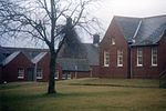
Moodiesburn

Moodiesburn is a village in Scotland, located 8 miles (13 kilometres) northeast of Glasgow, in the North Lanarkshire council area. It is situated on the north side of the A80 road and between the M73 and M80 motorways which converge nearby. Moodiesburn does not directly adjoin any other settlements, though the villages of Chryston and Muirhead are located a short distance to the west (the boundary being the Strathkelvin railway path there after you would be in Chryston), with Stepps beyond, and outer parts of Cumbernauld lie to the east; however, the town centres are about 5 miles (8 kilometres) apart.The village's economic standing greatly declined in the latter half of the 20th century, following the Auchengeich mining disaster and the disintegration of local employment. In recent times, the economic demographic of the population has improved. Good transport links enable a significant proportion of the population travel to the City of Glasgow, or nearby towns for employment in the professional and commercial sphere. The village is also located near several historical and cultural landmarks, including the Antonine Wall, a UNESCO World Heritage Site that was built by the Romans in the 2nd century AD. The area is popular with hikers and outdoor enthusiasts due to its scenery and proximity to the Scottish countryside.
Excerpt from the Wikipedia article Moodiesburn (License: CC BY-SA 3.0, Authors, Images).Moodiesburn
Pine Crescent,
Geographical coordinates (GPS) Address Nearby Places Show on map
Geographical coordinates (GPS)
| Latitude | Longitude |
|---|---|
| N 55.918333 ° | E -4.08666 ° |
Address
Pine Crescent
Pine Crescent
G69 0DB
Scotland, United Kingdom
Open on Google Maps


