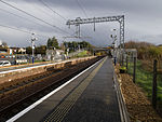
Garnkirk
Populated places in North LanarkshireWest of Scotland geography stubs

Garnkirk is a settlement in North Lanarkshire, located a mile (1.5 km) southwest of Muirhead. It is located 10 km northeast of Glasgow's city centre and 23 km southwest of Falkirk. Garnkirk is connected via the nearby motorways M8, M73 and M80. This provides access to Cumbernauld, Glasgow and Stirling. The nearest modern railway stations are in Gartcosh and Stepps.
Excerpt from the Wikipedia article Garnkirk (License: CC BY-SA 3.0, Authors, Images).Garnkirk
Woodhead Road,
Geographical coordinates (GPS) Address Nearby Places Show on map
Geographical coordinates (GPS)
| Latitude | Longitude |
|---|---|
| N 55.893 ° | E -4.115 ° |
Address
Woodhead Road
Woodhead Road
G69 9JB
Scotland, United Kingdom
Open on Google Maps


