Camelon
Roman legionary fortresses in ScotlandUse British English from June 2019Villages in Falkirk (council area)

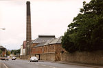
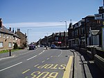
Camelon (; Scots: Caimlan, Scottish Gaelic: Camalan) is a large settlement within the Falkirk council area, Scotland. The village is in the Forth Valley, 1.3 miles (2.1 km) west of Falkirk, 1.3 miles (2.1 km) south of Larbert and 2.6 miles (4.2 km) east of Bonnybridge. The main road through Camelon is the A803 road which links the village to Falkirk. At the time of the 2001 census, Camelon had a population of 4,508.
Excerpt from the Wikipedia article Camelon (License: CC BY-SA 3.0, Authors, Images).Camelon
Glasgow Road,
Geographical coordinates (GPS) Address Nearby Places Show on map
Geographical coordinates (GPS)
| Latitude | Longitude |
|---|---|
| N 56.004596 ° | E -3.817454 ° |
Address
Glasgow Road 16
FK1 4HJ , Camelon
Scotland, United Kingdom
Open on Google Maps


