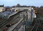
Selby toll bridge

Selby Toll Bridge is one of three swing bridges in the town of Selby, North Yorkshire, England. A timber bridge over the River Ouse in the town was opened in c. 1793 to replace a ferry crossing that had existed since Medieval times. The bridge provided a connection between the West and East Ridings of Yorkshire across the River Ouse, and became the furthest downstream public bridge crossing over the river until 1929, when the Boothferry Bridge was built. The moving section of the original bridge used ball-bearings and cog wheels; the bridge is believed to be the first in the world to use ball-bearings. The replacement 1970s bridge, now only carries the A19 road as the A63 bypass was opened in 2004.
Excerpt from the Wikipedia article Selby toll bridge (License: CC BY-SA 3.0, Authors, Images).Selby toll bridge
The Toll Bridge,
Geographical coordinates (GPS) Address Nearby Places Show on map
Geographical coordinates (GPS)
| Latitude | Longitude |
|---|---|
| N 53.785 ° | E -1.064 ° |
Address
The Toll Bridge
YO8 8FA , Barlby with Osgodby
England, United Kingdom
Open on Google Maps


