place

Princes Park (Liverpool ward)

ToxtethUse British English from March 2015Wards of Liverpool

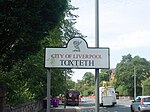
Princes Park is a Liverpool City Council Ward in the Liverpool Riverside Parliamentary constituency. The population of the ward taken at the 2011 census was 17,104. The ward is ethnically diverse, with a 53% white, 16% black, 9% asian and 10% mixed ethnicity population.The ward was formed for the 2004 Municipal elections taking the whole of the former Granby ward with part of the former Abercromby ward. It contains the Canning area and parts of Dingle and Toxteth areas as well as Princes Park itself. The Liverpool Women's Hospital is also within its bounds.

Excerpt from the Wikipedia article Princes Park (Liverpool ward) (License: CC BY-SA 3.0, Authors).

Princes Park (Liverpool ward)
Park Place, Liverpool Toxteth

Geographical coordinates (GPS) Address Nearby Places
placeShow on map

Wikipedia: Princes Park (Liverpool ward)Continue reading on Wikipedia

Geographical coordinates (GPS)

Latitude Longitude
N 53.392 ° E -2.972 °
placeShow on map

Address

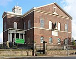
PARK PLACE/ST PATRICKS CHURCH

Park Place
L8 5US Liverpool, Toxteth
England, United Kingdom
mapOpen on Google Maps

Share experience

Nearby Places

Liverpool Cathedral
Liverpool Cathedral

Liverpool Cathedral is the Cathedral of the Anglican Diocese of Liverpool, built on St James's Mount in Liverpool, and the seat of the Bishop of Liverpool. It may be referred to as the Cathedral Church of Christ in Liverpool (as recorded in the Document of Consecration) or the Cathedral Church of the Risen Christ, Liverpool, being dedicated to Christ 'in especial remembrance of His most glorious Resurrection'. Liverpool Cathedral is the largest cathedral and religious building in Britain, and the eighth largest church in the world. The cathedral is based on a design by Giles Gilbert Scott and was constructed between 1904 and 1978. The total external length of the building, including the Lady Chapel (dedicated to the Blessed Virgin), is 207 yards (189 m) making it the longest cathedral in the world; its internal length is 160 yards (150 m). In terms of overall volume, Liverpool Cathedral ranks as the fifth-largest cathedral in the world and contests with the incomplete Cathedral of St. John the Divine in New York City for the title of largest Anglican church building. With a height of 331 feet (101 m) it is also one of the world's tallest non-spired church buildings and the fourth-tallest structure in the city of Liverpool. The cathedral is recorded in the National Heritage List for England as a designated Grade I listed building.The Anglican cathedral is one of two cathedrals in the city. The Roman Catholic Metropolitan Cathedral of Liverpool is situated approximately half a mile to the north. The cathedrals are linked by Hope Street, which takes its name from William Hope, a local merchant whose house stood on the site now occupied by the Philharmonic Hall, and was named long before either cathedral was built.

Gambier Terrace
Gambier Terrace

Gambier Terrace (Liverpool, England) is a street of 19th-century houses overlooking St. James's Mount and Gardens and Liverpool Cathedral. It is generally reckoned to be in Canning, although it falls within the Rodney Street conservation area, together with Hope Street and Rodney Street. It was named after James Gambier. Numbers 1 to 10 are Grade II* Listed Buildings, as is the northernmost house in the terrace, which has the address of Canning St around the corner. They were probably designed by John Foster, Junior. The terrace was built in 1832–1837. It was originally planned that the entire row would be built in a single style but construction was halted in the slump of 1837, and the demand for large city houses declined as the middle class moved out to the new suburbs. Number 10 was the last of the original build. The terrace was later completed to a cheaper specification. During the First World War Number 1 Gambier Terrace was the location of the Women's War Service Bureau which assisted soldiers and their families. The service expanded into 5 additional premises on Bold Street and Berry Street.In the 1950/60's Nos:11-12 Gambier Terrace was home to the Liverpool Art High School, the junior section of the Liverpool College of Art. The students were aged 13-16 years of age who won scholarships to attend the school. Cynthia Lennon was a student there before she met John Lennon. Also a student there was Peter Chang (1944–2017) he was a British artist known for his distinctive jewellery. He later trained as a graphic designer and sculptor at the Liverpool College of Art. He won the Liverpool Senior City Scholarship in 1966 which enabled him to study in Paris at Atelier 17 under S.W. Hayter. From the 1980s onward, he focused on jewellery-making. His collection was featured in Rifat Ozbek’s 1987 fashion show. His work is in collections around the world, including the Victoria and Albert Museum, the Metropolitan Museum of Art, and the Cooper Hewitt. John Lennon of The Beatles lived at 3 Gambier Terrace in 1960 with former Beatles bassist Stuart Sutcliffe after Sutcliffe asked the others who lived there, including fellow student and future well-known artist Margaret Chapman if the homeless Lennon could move in. They all attended nearby Liverpool College of Art. The freehold to the terrace and the garden in front belongs to Liverpool City Council. The land adjacent to Hope Street is maintained, in part, by the City Council and the leaseholders. The exact status of this land is unclear except that it is a public thoroughfare and unadopted by the City Council's highways department.