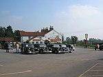
Stamford Bridge, East Riding of Yorkshire
Civil parishes in the East Riding of YorkshireStamford BridgeUse British English from June 2015Villages in the East Riding of Yorkshire

Stamford Bridge is a village and civil parish on the River Derwent in the East Riding of Yorkshire, England, approximately 5 miles (8 km) east of York and 22 miles (35 km) west of Driffield. The village sits astride an ancient ford on the River Derwent.Stamford Bridge is best known for : The Roman fort Derventio The Battle of Stamford Bridge (1066 AD) " Gefeoht æt Stanfordbrycge " The York–Beverley railway line (closed in 1965), railway station and viaduct The Stamford Bridge road crossing of the River Derwent
Excerpt from the Wikipedia article Stamford Bridge, East Riding of Yorkshire (License: CC BY-SA 3.0, Authors, Images).Stamford Bridge, East Riding of Yorkshire
Saxon Road,
Geographical coordinates (GPS) Address Nearby Places Show on map
Geographical coordinates (GPS)
| Latitude | Longitude |
|---|---|
| N 53.989 ° | E -0.912544 ° |
Address
Saxon Road
YO41 1BX , Stamford Bridge
England, United Kingdom
Open on Google Maps


