place

Thruxton Aerodrome

1942 establishments in EnglandAirports established in 1942Airports in HampshireCommons category link is locally definedUnited Kingdom airport stubs
Use British English from May 2013
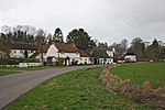
Thruxton Entrance to Race Circuit and Airport geograph.org.uk 1127787

Thruxton Aerodrome (ICAO: EGHO) is located in Thruxton, 4.5 NM (8.3 km; 5.2 mi) west of Andover, in Hampshire, England. The airfield was opened in 1942 as RAF Thruxton. Postwar, it was reopened by the Wiltshire School of Flying in 1947, and private and club flying operations continue to the present time. Thruxton Aerodrome has a CAA Ordinary Licence (Number P544) that allows flights for the public transport of passengers or for flying instruction as authorised by the licensee, Western Air (Thruxton) Limited.Motorbike racing began on a track using the runways and perimeter roads in 1950. Thruxton Circuit, which follows the line of the perimeter road, has been used for motorbike and car racing since 1968.Many air cadets were trained here on Flying Scholarships and gained their PPLs. The training was carried out by the Wiltshire School of Flying on DH.82 Tiger Moth and Jackaroo aircraft.

Excerpt from the Wikipedia article Thruxton Aerodrome (License: CC BY-SA 3.0, Authors, Images).

Thruxton Aerodrome
Snoddington Lane, Test Valley

Geographical coordinates (GPS) Address External links Nearby Places
placeShow on map

Wikipedia: Thruxton AerodromeContinue reading on Wikipedia

Geographical coordinates (GPS)

Latitude Longitude
N 51.210555555556 ° E -1.6 °
placeShow on map

Address

Thruxton Aerodrome

Snoddington Lane
SP9 7YQ Test Valley
England, United Kingdom
mapOpen on Google Maps

linkWikiData (Q3915170)
linkOpenStreetMap (71839281)

Thruxton Entrance to Race Circuit and Airport geograph.org.uk 1127787
Share experience

Nearby Places

Kimpton, Hampshire

Kimpton is a village and civil parish in the Test Valley district of Hampshire, England. The village is situated west of Andover, in the north of the county, and has a boundary with Ludgershall, in Wiltshire. South of Kimpton there is Thruxton motor racing circuit, in the parish of Thruxton. The main settlement in the parish is the village of Kimpton, in the south of the parish; in the north there is the hamlet of Shoddesden. In the 2001 census, the parish had a population of 352.Before the reorganisation of local government in 1974, the parish was in Andover Rural District.The A342 passes through the north-east corner of the parish. The Midland and South Western Junction Railway, which runs parallel to the road, was closed to passengers in 1961, however the line remains open as far as Ludgershall to serve an army depot on the edge of the town. Kimpton Down, a rural area in the north and west of the parish, contains the remains of several historical sites including bowl barrows and Roman buildings. Excavations near Shoddesden found a former Iron Age/Romano-British settlement site.A racehorse training complex at Kimpton Down Stables was opened in 2003 by Toby Balding. Ralph Beckett bought Kimpton Down Stables and gallops in late 2010, and trained Talent to win the 2013 Oaks at Epsom Downs Racecourse The Grade I listed Church of St Peter & St Paul is situated in the village. The church is built of flint, stone rubble and brick, and has a tower and a cruciform layout. The oldest parts of the church are the nave and chancel, built in the 13th century; other parts were added later. Kimpton Manor, originally built in 1444, is one of the oldest inhabited houses in Hampshire. The village has a small pub called The Welcome Stranger, The Kimpton Apple Press, a park and a village hall which also acts as a pre-school.

Grateley
Grateley

Grateley is a village and civil parish in the north west of Hampshire, England. The name is derived from the Old English grēat lēah, meaning 'great wood or clearing'.The village is divided into two distinct settlements, 0.75 miles (1.21 km) apart: the old village and a newer settlement built around the railway station on the West of England Main Line. The hamlet of Palestine adjoins the railway station settlement, although it is located in the civil parish of Over Wallop.Grateley lies just to the south of the prehistoric hill fort of Quarley Hill. The parish covers 1,551 acres (6.28 km2) with 616 people living in 250 dwellings. The village has one pub, a thirteenth-century church dedicated to St Leonard, a primary school, a school for children with Asperger syndrome, a railway station, a small business park, a golf driving range, and is surrounded by farmland with ancient footpaths and droveways. King Æthelstan issued his first official law code in Grateley in about 930 AD. Recorded in the early 12th century Quadripartitus text, which referred to a ‘great assembly at Grateley’ (magna synodo apud Greateleyam). The legestaive assembly and construct of the Grateley law code acted as a manifestation of the peripatetic nature of Anglo-Saxon kingship.In the 20th century Grateley was one of many ammunition dumps during the World Wars.The economic history of Grateley is agricultural, but less than 10% of the village population now rely upon agriculture as an occupation.