Stewartsville, Virginia
Census-designated places in Bedford County, VirginiaCensus-designated places in VirginiaCentral Virginia geography stubsPopulated places in Bedford County, VirginiaUse mdy dates from July 2023
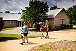
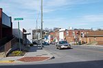
Stewartsville is a census-designated place (CDP) in southwestern Bedford County, Virginia, United States. The population as of the 2020 census was 533. The CDP is located along State Route 24, between Vinton and Chamblissburg. It is part of the Lynchburg Metropolitan Statistical Area.
Excerpt from the Wikipedia article Stewartsville, Virginia (License: CC BY-SA 3.0, Authors).Stewartsville, Virginia
Oddfellows Road,
Geographical coordinates (GPS) Address Nearby Places Show on map
Geographical coordinates (GPS)
| Latitude | Longitude |
|---|---|
| N 37.2708 ° | E -79.7927 ° |
Address
Oddfellows Road 1000
24179
Virginia, United States
Open on Google Maps


