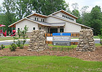
York Road (Charlotte neighborhood)
Mecklenburg County, North Carolina geography stubsNeighborhoods in Charlotte, North Carolina
York Road, and recently referred to as Lower South End (LoSo) by redevelopers and businesses wanting to emulate the Charlotte neighborhoods of NoDa and South End, is a mixed-use development neighborhood of commercial, industrial, and residential in Charlotte, North Carolina. Located along South Tryon Street (NC 49), it is bounded by Woodlawn Road to the south, Bill Lee Freeway (I-77/US 21) to the west, Clanton Road to the north, and South Boulevard to the east.
Excerpt from the Wikipedia article York Road (Charlotte neighborhood) (License: CC BY-SA 3.0, Authors).York Road (Charlotte neighborhood)
Yancey Road, Charlotte York Road
Geographical coordinates (GPS) Address Nearby Places Show on map
Geographical coordinates (GPS)
| Latitude | Longitude |
|---|---|
| N 35.187298 ° | E -80.880089 ° |
Address
The Olde Mecklenburg Brewery
Yancey Road 4150
28217 Charlotte, York Road
North Carolina, United States
Open on Google Maps


