place

Koivistonkylä

Districts of TampereWestern Finland Province geography stubs
Euromarket Koivistonkylä

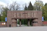
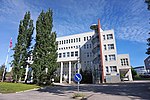
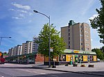
Koivistonkylä (also nicknamed Koikkari among the locals) is a district located in the southern part of Tampere, Finland. It borders Nekala in the north, Rautaharkko in the west, Taatala in the south and Veisu in the east. Many ice hockey players from Tampere come from Koivistonkylä, including Raimo Helminen. Koivistonkylä also has its own amateur ice hockey club called Koivistonkylän Chiefs.Koivistonkylä is named after the Koivisto croft that belonged to the village of Messukylä's church book. A crofter called Aukusti Koivisto redeemed the farm independently in the 1920s. At the same time, lively construction began in the area, and by the mid-1940s, about 400 estates had already been parcel out from it. Koivistonkylä moved to the city of Tampere in the Messukylä municipal association at the beginning of 1947.In connection with the construction of the motorway of Kulju, the village of Lempäälä, in the mid-1960s, part of Sulkavuori was cut to connect the old Lempääläntie to Koivistontie. The remaining spruce side on the Taatala side was destroyed in the way of Osuusliike Voima's Eka-Market, now Prisma, which was completed in 1977. Koivistonkylä's Eka-Market was Finland's first actual hypermarket. Finland's first self-service Alko store also came to the same building.

Excerpt from the Wikipedia article Koivistonkylä (License: CC BY-SA 3.0, Authors, Images).

Koivistonkylä
Koivistontie, Tampere Koivistonkylä (Eteläinen suuralue)

Geographical coordinates (GPS) Address Nearby Places
placeShow on map

Wikipedia: KoivistonkyläContinue reading on Wikipedia

Geographical coordinates (GPS)

Latitude Longitude
N 61.471078630556 ° E 23.791356469444 °
placeShow on map

Address

Koivistontie

Koivistontie
33800 Tampere, Koivistonkylä (Eteläinen suuralue)
Finland
mapOpen on Google Maps

Euromarket Koivistonkylä
Share experience

Nearby Places

Viinikka
Viinikka

Viinikka is a district of Tampere, Finland, located 1,5 kilometers southeast of its city center on the west side of Lake Iides. Its neighboring district is Nekala. Its construction began in 1914 on the former lands of Hatanpää Manor. The stone church, opened in 1932, is located in Viinikka.Viinikka's main streets are Viinikankatu in a north–south direction and Kuokkamaantie in a west–east direction from Lempääläntie to Nekala. The original name of Viinikankatu in 1939–1956 was Hervannantie, but the name was considered misleading because Hervanta is located quite far from the Viinikka district. Before the major street name reform carried out in Tampere in 1936, the current Tuomiokirkonkatu in the center of Tampere was known as Viinikankatu. Ahlmanintie, on the east side of Viinikankatu, is named after Gabriel Ahlman (1737–1799), an assessor who owned the Hatanpää Manor in the late 18th century. The land register of 1540 mentioned the village of Otavala, which belonged to Messukylä, where the houses of Otavala and Viinikka were located. The name Viinikka is thought to be of German origin. In 1757, Otavala passed to Hans Henrik Boije (1716–1781), the owner of the Hatanpää Manor and member of Parliament, who established a spinning school and a flax weaving mill on the farm. The school, called the “Otavalan spinni”, was designed to teach the handling of flax from sowing the seed to weaving the fabric. The spinning school, which had become a pawn of party politics at the time, was closed down after only a few years of operation, but it had time to pave the way for the flax mills established in Tampere in the 19th century. The Viinikka area was annexed to the city of Tampere after the Hatanpää Manor became the property of the city in 1913 and was reserved for a detached house. Viinikka's first town plan was approved in 1914, when the area was bounded on the north by Viinikanoja, on the east by Lake Iides and the Pahaoja pond, on the south by Pahalampi and on the west by the Riihimäki–Tampere railway. The town plans of the area were not finally approved until 1936–1954.

Kalevanharju
Kalevanharju

Kalevanharju (lit. 'Kaleva Esker') is a district of Tampere, Finland. It is bordered on the north by Liisankallio, on the northeast by Kaleva, on the east by Kalevanrinne, on the south by Hatanpää, on the west by Ratina and on the northwest by Tulli. The Central Campus of the Tampere University, the Kalevankangas Cemetery and the Tampere Adult Education Center are located in Kalevanharju. On the west side of the cemetery was the State General Hospital, which had moved there from the edge of Nalkala Square in 1910. The hospital, whose main building was in the shape of the letter H, contained features of Art Nouveau and Classicism. To the north of the hospital was the Kalevanharju orphanage, founded in 1925, which included a nursery and a milk distribution station for infants. In the area south and southwest of Kalevanharju, between the Tehdaskatu street and the Viinikanoja ditch, there were several small industrial plants: the Tampere's brewery, founded in 1922, the Tampere box factory, which started operations in 1923, and the Tuotannon leipomo bakery, designed by Frans Jousi, was built in 1927. Tehdaskatu 15, on the other hand, housed Osuusliike Voima's soft drink factory from 1924 onwards.Kalevanharju also has an urban cultivation garden called Kalevanharjun yhteisöviljelmä, where the townspeople grow food plants in cultivation sacks and boxes, experimenting together. The plantation has been in operation since spring 2014 and currently includes about 60 culture sacks and boxes, which are cultivated and cared for by a team of about 15 people.