Lifta
Arab villages depopulated prior to the 1948 Arab–Israeli WarGhost towns in AsiaHebrew Bible placesNeighbourhoods of JerusalemVague or ambiguous time from July 2019 ... and 1 more
Wikipedia extended-confirmed-protected pages

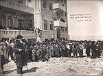
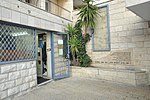
Lifta (Arabic: لفتا; Hebrew: ליפתא) was a Palestinian Arab village on the outskirts of Jerusalem. The village was depopulated during the early part of the 1947–1948 civil war in Mandatory Palestine. In July 2017, Israel declared Lifta (called Mei Neftoach) as a national nature reserve. It has been referred to as the "Palestinian Pompeii".
Excerpt from the Wikipedia article Lifta (License: CC BY-SA 3.0, Authors, Images).Lifta
מי נפתוח, Jerusalem Givat Shaul
Geographical coordinates (GPS) Address Nearby Places Show on map
Geographical coordinates (GPS)
| Latitude | Longitude |
|---|---|
| N 31.795277777778 ° | E 35.196388888889 ° |
Address
עין נפתוח (ליפתא)
מי נפתוח
9546522 Jerusalem, Givat Shaul
Jerusalem District, Israel
Open on Google Maps


