place

Milson, New Zealand

Populated places in Manawatū-WhanganuiSuburbs of Palmerston NorthUse New Zealand English from June 2023

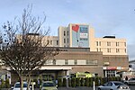
Milson is a suburb of Palmerston North, Manawatū-Whanganui, New Zealand. The suburb is located to the north of the city, beyond the North Island Main Trunk Rail. Milson is mostly a residential suburb with a population of 6,246 (2018). Milson is divided into a residential zone in the west and central and an industrial zone in the east. Palmerston North Airport and Palmerston North railway station are in Milson. Milson was part of the Papaioea Ward of Palmerston North City Council until 2013. It was part of the Manawatu electorate until 1996, when it became part of the Rangitikei electorate. Many other local streets and parks have a space or US presidential theme. For example, Apollo Park has a spaced-themed playground and a butterfly park. Other parks include Colquhoun Park, John F Kennedy Park, Clearview Park, Kennedy Park, Paradise Park, Pinedale Reserve, Langley Reserve, Clearview Reserve, Jefferson Reserve and Mangaone Stream Esplanade Reserve.

Excerpt from the Wikipedia article Milson, New Zealand (License: CC BY-SA 3.0, Authors).

Milson, New Zealand
Milson Line, Palmerston North Milson

Geographical coordinates (GPS) Address Nearby Places
placeShow on map

Wikipedia: Milson, New ZealandContinue reading on Wikipedia

Geographical coordinates (GPS)

Latitude Longitude
N -40.333333333333 ° E 175.61666666667 °
placeShow on map

Address

Milson Line
4414 Palmerston North, Milson
Manawatū-Whanganui, New Zealand
mapOpen on Google Maps

Share experience

Nearby Places

Papaioea
Papaioea

Papaioea is a suburb of Palmerston North on New Zealand's North Island. Its name comes from the name of the original settlement in a clearing in forest which was purchased from local Māori (Ngāti Rangitāne) in 1864. The name was used to describe Palmerston North also. Somewhat later, the name had become forgotten with the transliteration of Pamutana being preferred (especially by the Native Land Court).The name Papaioea did not resurface until the 1920s, and is sometimes used to refer to Palmerston North as a whole. Papaioea has many shops, food outlets and supermarkets, including Terrace End Shopping Centre (Broadtop) on Broadway Avenue. There are real estate agencies, a veterinarian clinic, medical clinics and several churches, including Broadway Methodist Church. Aorangi Hospital, formerly known as Mercy Hospital, was a private hospital in the northwest of the suburb. It has since been demolished, with services moved to Crest Hospital in nearby Carroll Street. The site is now occupied by Broadway Radiology who occupy a new, modern building. Horizons Regional Council office is also located in Papaioea. Papaioea Park is located in the north of the suburb. It is used as a football ground and cricket ground by lower club grades, and is walled on the Featherston Street and Ruahine Street boundary.Palmerston North Borough Council decided to reserve land for the park in the 1920s They chose the name Papaioea to commemorate the original settlement in the area. There was a spelling mistake and the name was spelt "Papaeoia". This was not corrected until the 1970s.The first stage of a new social housing development opened in the area in 2019. Palmerston North City Council applied for Government funding for a second stage of the project during the coronavirus pandemic in 2020.The Palmerston North Hospital area is identified as a separate area by Statistics New Zealand. On the southern side of Tremaine Avenue is a predominantly suburban area, with tree lined streets and avenues. The north side of Tremaine Avenue is dominated by commercial and industrial businesses. Features in the area include Arohanui Hospice, the Northern Bowling Club, Rimu Lodge Rest Home, Willard Rest Home, and Wahikoa Park.