place

Hokowhitu

Populated places on the Manawatū RiverSuburbs of Palmerston NorthUse New Zealand English from April 2023

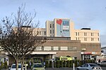
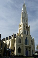
Hokowhitu is a riverside suburb of the New Zealand city of Palmerston North, with some of the highest property values in the city. The Palmerston North Teachers' College was built in Hokowhitu in the 1960s. Massey University took over the college in 2009. The New Zealand Defence Force began using some of the buildings in 2011.Massey relocated the college to Turitea campus in 2013 and sold the land in 2016. When the site was sold, the land consisted of 20 buildings; including halls, offices, a library, a marae and sporting facilities. The site began to be redeveloped into housing in 2018.The Hokowhitu Lagoon, Caccia Birch House, Jickell Street Reserve and Manawatu Golf Course are located next to the former education campus. Wallace Park, the home of the Ruahine Association Football Club and local cricket teams, is located nearby. Other local features include the Hokowhitu Domain, Crewe Crescent Reserve, Franklin Reserve, Fitzroy Bend Park, Milverton Park and playground, Awatea Reserve and stream, Hardie St Park and Centennial Drive Reserve.Hokowhitu is part of the Palmerston North and Te Tai Hauāuru electorates. Until 2013, it had its own ward councilors on the Palmerston North City Council.

Excerpt from the Wikipedia article Hokowhitu (License: CC BY-SA 3.0, Authors).

Hokowhitu
Te Awe Awe Street, Palmerston North Hokowhitu

Geographical coordinates (GPS) Address Nearby Places
placeShow on map

Wikipedia: HokowhituContinue reading on Wikipedia

Geographical coordinates (GPS)

Latitude Longitude
N -40.3625 ° E 175.63333333333 °
placeShow on map

Address

Te Awe Awe Street 190
4410 Palmerston North, Hokowhitu
Manawatū-Whanganui, New Zealand
mapOpen on Google Maps

Share experience

Nearby Places

Papaioea
Papaioea

Papaioea is a suburb of Palmerston North on New Zealand's North Island. Its name comes from the name of the original settlement in a clearing in forest which was purchased from local Māori (Ngāti Rangitāne) in 1864. The name was used to describe Palmerston North also. Somewhat later, the name had become forgotten with the transliteration of Pamutana being preferred (especially by the Native Land Court).The name Papaioea did not resurface until the 1920s, and is sometimes used to refer to Palmerston North as a whole. Papaioea has many shops, food outlets and supermarkets, including Terrace End Shopping Centre (Broadtop) on Broadway Avenue. There are real estate agencies, a veterinarian clinic, medical clinics and several churches, including Broadway Methodist Church. Aorangi Hospital, formerly known as Mercy Hospital, was a private hospital in the northwest of the suburb. It has since been demolished, with services moved to Crest Hospital in nearby Carroll Street. The site is now occupied by Broadway Radiology who occupy a new, modern building. Horizons Regional Council office is also located in Papaioea. Papaioea Park is located in the north of the suburb. It is used as a football ground and cricket ground by lower club grades, and is walled on the Featherston Street and Ruahine Street boundary.Palmerston North Borough Council decided to reserve land for the park in the 1920s They chose the name Papaioea to commemorate the original settlement in the area. There was a spelling mistake and the name was spelt "Papaeoia". This was not corrected until the 1970s.The first stage of a new social housing development opened in the area in 2019. Palmerston North City Council applied for Government funding for a second stage of the project during the coronavirus pandemic in 2020.The Palmerston North Hospital area is identified as a separate area by Statistics New Zealand. On the southern side of Tremaine Avenue is a predominantly suburban area, with tree lined streets and avenues. The north side of Tremaine Avenue is dominated by commercial and industrial businesses. Features in the area include Arohanui Hospice, the Northern Bowling Club, Rimu Lodge Rest Home, Willard Rest Home, and Wahikoa Park.