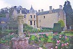
Strathmiglo
Fife geography stubsParishes in FifeVillages in Fife

Strathmiglo (Scottish Gaelic: Srath Mioglach) (Ordnance Survey grid reference NO214101) is a village and parish in Fife, Scotland on the River Eden. It lies on the old A91 road from Milnathort to Cupar and St. Andrews but was bypassed by a new road to the north in the 1970s. Nearby settlements include Auchtermuchty and Falkland.
Excerpt from the Wikipedia article Strathmiglo (License: CC BY-SA 3.0, Authors, Images).Strathmiglo
Heckler's Wynd,
Geographical coordinates (GPS) Address Nearby Places Show on map
Geographical coordinates (GPS)
| Latitude | Longitude |
|---|---|
| N 56.27684 ° | E -3.27095 ° |
Address
Heckler's Wynd
Heckler's Wynd
KY14 7PP
Scotland, United Kingdom
Open on Google Maps


