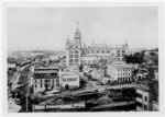
Northeast, Minneapolis

Northeast is a defined community in the U.S. city of Minneapolis that is composed of 13 smaller neighborhoods whose street addresses end in "NE". Unofficially it also includes the neighborhoods of the University community which have "NE" addresses, and the entirety of the Old Saint Anthony business district, which sits on the dividing line of "NE" and "SE" addresses. In the wider community, this business district, which is the oldest settlement in the city, is often identified as the heart of Northeast, in part because it lies across the Mississippi River from Downtown Minneapolis. Northeast is sometimes referred to as "Nordeast", reflecting the history of northern and eastern European immigrants and their language influence. The modern community includes commercial districts stretching along the major corridors of University Avenue, Central Avenue, East Hennepin Avenue, Broadway Street, and Stinson and New Brighton Boulevards towards the city limits. Blending a heritage of old architecture, classic housing, bustling commercial streets, and industrial work centers, along with new residential high-rises, suburban cul-de-sacs, big-box retail, and a popular art scene, Northeast offers diverse amenities as part bedroom neighborhood and job center for the city of Minneapolis. The prominent features of Northeast include ornate Eastern European influenced churches and massive grain silos and mills. Mostly built around the late 19th to early 20th century, these structures shadow the landscape of modest Victorians and four story apartments. The area was the City of St. Anthony before it was annexed into Minneapolis, and is thus sometimes confused with the city named Saint Anthony which abuts Northeast Minneapolis on the northeast, or Saint Anthony Park, a Saint Paul neighborhood that abuts it to the northeast.
Excerpt from the Wikipedia article Northeast, Minneapolis (License: CC BY-SA 3.0, Authors, Images).Northeast, Minneapolis
Southeast Central Avenue, Minneapolis
Geographical coordinates (GPS) Address Nearby Places Show on map
Geographical coordinates (GPS)
| Latitude | Longitude |
|---|---|
| N 44.987222222222 ° | E -93.254444444444 ° |
Address
United Labor Centre
Southeast Central Avenue 312
55413 Minneapolis
Minnesota, United States
Open on Google Maps


