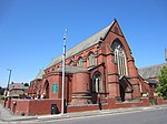
Stranton

Stranton is an area of south Hartlepool in the borough of Hartlepool, County Durham, England. It is a former village and parish. The ancient parish boundaries were the North Sea to the east, Greatham Creek, an arm of the Tees, to the south, the parish of Greatham to the south-west, and the Greatham Beck to the west. In 1831, the parish contained the townships of Stranton, Seaton Carew, and Brierton.The area’s name was last used as an electoral ward name in the 2011 UK Census, with a population of 6,105. It covered most of the town centre with parts of Stranton in the south west of the ward. For the 2015 general election Burn Valley, Headland & Harbour and Victoria replaced the majority of the former ward area.
Excerpt from the Wikipedia article Stranton (License: CC BY-SA 3.0, Authors, Images).Stranton
Brierton Lane,
Geographical coordinates (GPS) Address Nearby Places Show on map
Geographical coordinates (GPS)
| Latitude | Longitude |
|---|---|
| N 54.666 ° | E -1.224 ° |
Address
Stranton Crematorium
Brierton Lane
TS25 5DN , Foggy Furze
England, United Kingdom
Open on Google Maps


