place

KRCN

1949 establishments in ColoradoCatholic radio stationsChristian radio stations in ColoradoLongmont, ColoradoRadio stations established in 1949

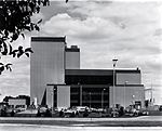
KRCN (1060 AM) is a radio station broadcasting a Catholic radio format. Licensed to Longmont, Colorado, the station is owned and operated by Catholic Radio Network, Inc., which has a network of stations in Missouri, Kansas and Colorado. In Colorado, the Catholic Radio Network also operates KFEL 970 AM in Colorado Springs and KCRN 1120 AM in Limon. KRCN broadcasts at 50,000 watts, the maximum power for FCC-licensed AM radio stations. But because AM 1060 is a clear channel frequency reserved for Class A XECPAE Mexico City and KYW Philadelphia, KRCN must greatly reduce nighttime power. It drops to only 111 watts at sunset. KRCN can also be heard on an FM translator station in Greeley, Colorado, 92.1 K221GI.

Excerpt from the Wikipedia article KRCN (License: CC BY-SA 3.0, Authors).

KRCN
Colorado Boulevard,

Geographical coordinates (GPS) Address Nearby Places
placeShow on map

Wikipedia: KRCNContinue reading on Wikipedia

Geographical coordinates (GPS)

Latitude Longitude
N 40.280833333333 ° E -104.94027777778 °
placeShow on map

Address

Colorado Boulevard

Colorado Boulevard

Colorado, United States
mapOpen on Google Maps

Share experience

Nearby Places

Anderson Barn (Johnstown, Colorado)

The Anderson Barn near Johnstown in Weld County, Colorado, also known as the Carlson Barn, is a gambrel-roofed ornamental block building built in 1913. It was listed on the National Register of Historic Places in 2004.It is about 25 by 70 feet (7.6 m × 21.3 m) in plan. It has walls built of plain-faced ornamental blocks. Its gambrel roof, covered in asphalt shingles in 2004, has two large metal ventilators and a hay hood projecting out the ridge on the south side.It was deemed "an excellent example of a gambrel-roofed barn using plain-faced ornamental concrete block for its lower level." It might have been built from a kit, as might be sold by "mail-order firms as Sears, Roebuck and Company, Montgomery Ward, and the Aladdin Company. The blocks were to be made on-site with a hand-operated machine supplied in the kit. The remainder of the materials (cement, lumber, roofing, windows and hardware) were shipped by rail to the nearest siding. Local contractors or property owners fabricated the blocks, laid the masonry walls and then built the frame interior and roof structure."It is located in a cluster of farm buildings to the north of Colorado State Highway 60, about .2 miles (0.32 km) due east of the eastern end of Johnstown Reservoir. The other buildings include a seed shed, a livestock shed, and two poured-concrete silos. Albert Anderson, who immigrated from Sweden in 1912, purchased the property. He, C.E. "Cement" Carlson, and four young Russian immigrants built the barn, with blocks that were individually formed using a hand cement mixer."The barn originally accommodated draft horse stalls and family milk cows. The loft was used for the storage of hay and straw.The barn has been well maintained throughout the years. About ten years ago the building was re- shingled by Ray Ezinga, a contractor from Loveland, Colorado. The work cost $6,000. Two years ago a painter from Loveland painted the barn and other buildings, including the machine, seed, and livestock sheds, for a total cost of $5,200."Melvin Carlson and family members long participated in quarter horse shows. He is a member of the Rocky Mountain Quarter Horse Association and of the National Western Stock Show Livestock Association: In 2002, the barn was nominated for the Barn Again! Farm Heritage Award sponsored by Successful Farming magazine and the National Trust for Historic Preservation. Melvin Carlson received a certificate of commendation "in recognition of outstanding efforts in preserving and maintaining America's Rural Heritage." In 2004 the farm buildings' property is owned by Albert's grandson Melvin Carlson, although all but 10 acres (4.0 ha) of the farm's land was sold for development in 1999.

St. Vrain Creek
St. Vrain Creek

St. Vrain Creek (often known locally as the St. Vrain River) is a tributary of the South Platte River, approximately 32.2 miles (51.8 km) long, in north central Colorado in the United States. It drains part of the foothills north of Boulder and the Colorado Piedmont area in the vicinity of Longmont. The creek is formed by the confluence of North and South St. Vrain creeks at Lyons. The creek rises in several branches in the foothills of the Front Range northwest of Boulder. Middle St. Vrain Creek rises along the continental divide, west of St. Vrain Mountain. It descends in canyon to flow along State Highway 7 and past Raymond. It joins the shorter South St. Vrain Creek about two miles below Raymond. Parts of the South St. Vrain Creek form a five-mile (8.0 km) Class 5+ kayak run during normal flows. North St. Vrain Creek rises northeast of St. Vrain Mountain near Mount Alice and Chiefs Head Peak, and descends in a remote canyon to the east along U.S. Highway 36. The two branches join at Lyons, at the mouth of the canyon. East of Lyons, the combined stream flows southeast through farmland and ranch country, passing south of Hygiene and entering Longmont. It passes through the south side of Longmont where it is rimmed by a greenway trail and several parks. East of Longmont it flows generally northeast, meandering through a wide river bottom in ranch country and passing under Interstate 25 south of the intersection with State Highway 66. It joins the South Platte from the west just upstream from the ruins of Fort St. Vrain and approximately four miles (6.4 km) northwest of Platteville. St. Vrain Creek is joined by Left Hand Creek south of Longmont and Boulder Creek east of Longmont. The stream was named after Ceran St. Vrain, a pioneer trader.

Fort Saint Vrain
Fort Saint Vrain

Fort Saint Vrain was an 1837 fur trading post built by the Bent, St. Vrain Company, and located at the confluence of Saint Vrain Creek and the South Platte River, about 20 miles (32 km) east of the Rocky Mountains in the unorganized territory of the United States, in present-day Weld County, Colorado. A historical marker notes the place where Old Fort St. Vrain once stood, today at the end of Weld County Road 40, located about seven miles north of Fort Vasquez, Colorado. Among those who helped to establish the fort was Ceran St. Vrain, after whom it was named. William Clark, governor of the territory, granted the Bent, St. Vrain Co. a license to trade on November 8, 1836. Like neighboring forts, the structure was built as a two-story adobe structure whose walls encased an interior courtyard. It accommodated trade with Native American tribes and mountain men engaged in fur trapping. It resembled the adobe building and plaza reconstructed at Fort Vasquez and Bent's Old Fort. Marcellin St. Vrain, Ceran's brother, managed the trading post. He employed such notable people as James Beckwourth, a mountain man, and Jean Baptiste Charbonneau, who was born to Sacajewea during the 1804-1806 Lewis and Clark Expedition. She accompanied the expedition with her husband, trader & trapper Toussaint Charbonneau as well as newborn Jean Baptiste, while filling the crucial role of translator to the Shoshone Indian tribe. After the Taos Revolt in 1847, the St. Vrain brothers both returned to St. Louis. After Ceran St. Vrain sold his shares of the Bent, St. Vrain Co., William Bent became sole proprietor by 1849. Bent moved to Fort St. Vrain temporarily before building a new Fort Bent in the Big Timbers area.