place

Point Isabel Regional Shoreline
1975 establishments in CaliforniaDog parks in the United StatesEast Bay Regional Park DistrictParks in Richmond, CaliforniaProtected areas established in 1975
San Francisco Bay Trail
Pointislabelregionalshoreline2019

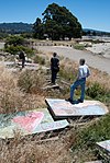
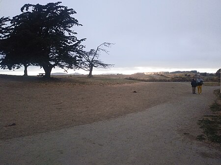
Point Isabel Regional Shoreline in Richmond, California, is operated by East Bay Regional Park District, and is a multi-use park for joggers, windsurfers, kayakers, photographers, picnickers, and people walking dogs. It has access for pedestrians and via public transit, private vehicles, and bikes (although bike-riding within Point Isabel itself is not allowed). It also features a concession offering food for people and grooming for pets. A longtime community organization and nonprofit, Point Isabel Dog Owners and Friends (PIDO), is active in the maintenance and improvement of the park. Point Isabel was closed from March 31, 2020 to June 1, 2020, as a precaution during the early days of the COVID-19 pandemic. Dogs were required to be on-leash during the first week after the reopening but off-leash privileges were restored on June 8, 2020. As throughout East Bay Regional Park District, social distancing measures apply.

Excerpt from the Wikipedia article Point Isabel Regional Shoreline (License: CC BY-SA 3.0, Authors, Images).

Point Isabel Regional Shoreline
Isabel Street, Richmond

Geographical coordinates (GPS) Address Website External links Nearby Places
placeShow on map

Wikipedia: Point Isabel Regional ShorelineContinue reading on Wikipedia

Geographical coordinates (GPS)

Latitude Longitude
N 37.899 ° E -122.3243 °
placeShow on map

Address

Point Isabel Regional Shoreline

Isabel Street
94850 Richmond
California, United States
mapOpen on Google Maps

Website
ebparks.org

linkVisit website

linkWikiData (Q7208054)
linkOpenStreetMap (10324698)

Pointislabelregionalshoreline2019
Share experience

Nearby Places

Baxter Creek
Baxter Creek

Baxter Creek or Stege Creek (also archaically Bishop Creek), is a three-branch creek in Richmond and El Cerrito, California, United States, forming the Baxter Creek watershed. The creek has three sources and flows from the Berkeley Hills to Stege Marsh and the San Francisco Bay. The Baxter Creek watershed at-large has 10 sources.The creek has been largely culverted over the years since the Rancho San Pablo and the subdivided Bishop Ranch, then known as Bishop Creek, were urbanized. Residents missed the creek when it disappeared under the asphalt and formed Friends of Baxter Creek. This group has aided in the restoration of several portions of the creek. Baxter Creek Park, Poinsett Park, and Booker T. Anderson Park are now in a more natural riparian condition, though the Anderson Park portion has been plagued by litter and shopping carts. The Ohlone Greenway bicycle and pedestrian path has its northern terminus at Baxter Creek Gateway Park, located just north of where the BART tracks cross over San Pablo Avenue in Richmond. The origins of the name Baxter Creek is unknown, but historians believe it to be from a family which once owned land in the area. Stege is from Richard Stege and Bishop comes from Thomas Bishop, who once owned large tracts of land in the area.Much of the streamside vegetation that had been restored to Booker T. Anderson Park was chainsawed away and leveled due to concerns that the riparian habitat hid muggings, drug dealings, and public sex from police patrols.

Richmond Annex, Richmond, California

Richmond Annex or The Annex is a neighborhood in southeastern Richmond, California. It is mostly residential and located between San Pablo Avenue/El Cerrito to the east, San Francisco Bay to the west, Central Avenue/Cerrito Creek/Albany Hill/Albany/Alameda County to the south, and Potrero Avenue/Pullman to the north. Carlson Boulevard is the main thoroughfare through the annex, connecting downtown Richmond with downtown El Cerrito. In the segment of San Pablo Avenue that forms the boundary between Richmond and El Cerrito, the buildings on the western side (which are in Richmond Annex) have an El Cerrito postal address and their occupants are sometimes mistakenly described as being in El Cerrito, such as El Cerrito Natural Grocery Company and Down Home Records (formerly Arhoolie Records). According to a local history written down by Fay Breneman circa 1941, "The land now known as Richmond Annex was farmed by the Conlon Brothers." The 1894 map showing the final verdict in Emeric V. Alvarado shows the entire Annex as the property of William Meyer (written on map as "Wm. Meyer"). It was annexed by the City of Richmond on September 26, 1926, after a 13-12 vote on whether to join Richmond or El Cerrito. In recent years, Richmond Annex has been home to the Pacific East Mall, a large collection of Chinese stores, the largest of its kind in the East Bay. Other significant landmarks include: The Richmond Annex Senior Center, which was a firehouse from 1937-1976, and Huntington playground Park. The residents have also rallied successfully for a cell phone tower to not be built, had major input on the Carlson boulevard Interstate 80 overpass mural, and kept Fairmont elementary school in neighboring El Cerrito from being closed.