Cerrito Creek

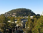
Cerrito Creek is one of the principal watercourses running out of the Berkeley Hills into San Francisco Bay in northern California. It is significant for its use as a boundary demarcation historically, as well as presently. In the early 19th century, it separated the vast Rancho San Antonio to the south from the Castro family's Rancho San Pablo to the north. Today, it marks part of the boundary between Alameda County and Contra Costa County. The main stem, running through a deep canyon that separates Berkeley from Kensington, is joined below San Pablo Avenue by a fan of tributaries, their lower reaches mostly in culverts. The largest of these is Middle or Blackberry Creek, a southern branch. The creek is named for Albany Hill, formerly called Cerrito de San Antonio, a prominent (elevation 294 ft.) isolated hill on the shoreline of San Francisco Bay in Albany (The hill is now some distance inland due to Bay fill). Cerrito Creek, joined by a fan of other small creeks, formerly meandered to the Bay through a large marsh just north of the hill.
Excerpt from the Wikipedia article Cerrito Creek (License: CC BY-SA 3.0, Authors, Images).Cerrito Creek
Bay Trail,
Geographical coordinates (GPS) Address Nearby Places Show on map
Geographical coordinates (GPS)
| Latitude | Longitude |
|---|---|
| N 37.896944444444 ° | E -122.31194444444 ° |
Address
Bay Trail
Bay Trail
94850
California, United States
Open on Google Maps


