Franklin Square (Savannah, Georgia)

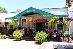
Franklin Square is one of the 22 squares of Savannah, Georgia, United States. It is located in the northernmost row of the city's five rows of squares, at Montgomery Street and West St. Julian Street. It is west of Ellis Square in the northwestern corner of the city's grid of squares. The square now anchors the western end of the City Market retail area.The oldest building on the square is 317 West Bryan Street, the Abram Minis Building, which dates to 1846.The square is named for Benjamin Franklin, one of the Founding Fathers of the United States. It once contained a forty-foot-tall water tower to distribute water to residents. It was built with after the previous system of public and private surface wells was overwhelmed by the rising population of the city. The water was taken out of the Savannah River west of the Ogelthorpe Canal Basin before being filtered and pumped up to the water tower. Because of the tower, Franklin Square was also known as Water Tank Square, Water Tower Square and Reservoir Square.The square was destroyed in 1935 with the routing of U.S. Highway 17 on Montgomery Street but was restored in the mid-1980s. In 1967, Montgomery Street was changed from two-way to one-way between Jones and Bay streets; in 1985, however, to assist with the restoration of Franklin Square, it was restored to two-way traffic between Bay and Broughton streets. In 2019, the bi-directional traffic flow was extended from Broughton to Liberty streets.
Excerpt from the Wikipedia article Franklin Square (Savannah, Georgia) (License: CC BY-SA 3.0, Authors, Images).Franklin Square (Savannah, Georgia)
Montgomery Street, Savannah Savannah Historic District
Geographical coordinates (GPS) Address Nearby Places Show on map
 Continue reading on Wikipedia
 Geographical coordinates (GPS)
| Latitude | Longitude |
|---|---|
| N 32.081 ° | E -81.0959 ° |
Address
Montgomery Street
31401 Savannah, Savannah Historic District
Georgia, United States
Open on Google Maps