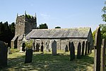
St Germans, Cornwall

St Germans (Cornish: Lannaled) is a village and civil parish in east Cornwall, England, United Kingdom. It stands on the River Tiddy, just upstream of where that river joins the River Lynher; the water way from St Germans to the Hamoaze is also known as St Germans River. It takes its name from the St. German's Priory, generally associated with St Germanus, although the church may have been associated initially with a local saint, who was gradually replaced by the 14th century. This Norman church is adjacent to the Port Eliot estate of the present Earl of St Germans. The other villages in the historic parish were Tideford, Hessenford, Narkurs, Polbathic, and Bethany, but new ecclesiastical parishes were established in 1834 (St Anne's Church, Hessenford) and 1852 (Tideford). In 1997 part of the St Germans parish was made into Deviock parish. The area of the civil parish is 10,151 acres (4,108 ha), and it has a population of 1,427, increasing to 1,453 at the 2011 census. An electoral ward with the name St Germans also exists. The population at the 2011 census was 4,301.
Excerpt from the Wikipedia article St Germans, Cornwall (License: CC BY-SA 3.0, Authors, Images).St Germans, Cornwall
Church Street,
Geographical coordinates (GPS) Address Nearby Places Show on map
Geographical coordinates (GPS)
| Latitude | Longitude |
|---|---|
| N 50.396 ° | E -4.31 ° |
Address
Church Street
PL12 5LG , St. Germans
England, United Kingdom
Open on Google Maps


