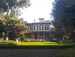
Eastern Goleta Valley, California
Census-designated places in CaliforniaCensus-designated places in Santa Barbara County, CaliforniaSanta Barbara County, California geography stubsUse mdy dates from July 2023
Eastern Goleta Valley is a census-designated place (CDP) in Santa Barbara County, California, United States. It is located between Goleta to the west, Santa Barbara to the east, the Pacific Ocean to the south, and the Santa Ynez Mountains to the north. It was first listed as a CDP prior to the 2020 census.
Excerpt from the Wikipedia article Eastern Goleta Valley, California (License: CC BY-SA 3.0, Authors).Eastern Goleta Valley, California
North Turnpike Road,
Geographical coordinates (GPS) Address Nearby Places Show on map
Geographical coordinates (GPS)
| Latitude | Longitude |
|---|---|
| N 34.444444444444 ° | E -119.78916666667 ° |
Address
Wake Campus SBCC
North Turnpike Road 300
93111
California, United States
Open on Google Maps


