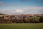
Neilston (Scots: Neilstoun, Scottish Gaelic: Baile Nèill, pronounced [paləˈnɛːʎ]) is a village and parish in East Renfrewshire in the west central Lowlands of Scotland. It is in the Levern Valley, two miles (three kilometres) southwest of Barrhead, 3+3⁄4 miles (6 kilometres) south of Paisley, and 5+3⁄4 miles (9.5 kilometres) south-southwest of Renfrew, at the southwestern fringe of the Greater Glasgow conurbation. Neilston is a dormitory village with a resident population of just over 5,000 people.
Neilston is mentioned in documents from the 12th century, when the feudal lord Robert de Croc, endowed a chapel to Paisley Abbey to the North. Neilston Parish Church—a Category B listed building—is said to be on the site of this original chapel and has been at the centre of the community since 1163. Little remains of the original structure. Before industrialisation, Neilston was a scattered farming settlement composed of a series of single-storey houses, many of them thatched. Some domestic weaving was carried out using local flax. Water power from nearby streams ground corn and provided a suitable environment for bleaching the flax.
The urbanisation and development of Neilston came largely with the Industrial Revolution. Industrial scale textile processing was introduced to Neilston around the middle of the 18th century with the building of several cotton mills. Neilston became a centre for cotton and calico bleaching and printing in the 18th century, which developed into a spinning and dying industry, and continued into the early 20th century. Although Neilston is known as a former milling village, agriculture has played, and continues to play, an economic role. The annual Neilston Agricultural Show is an important trading and cultural event for farmers from southwest Scotland each spring.Although heavy industry died out in the latter half of the 20th century, as part of Scotland's densely populated Central Belt, Neilston has continued to grow as a commuter village, supported by its position between Paisley and Glasgow, from roughly 1,000 people in 1800 to 5,168 in 2001. Expansion continues due to several new housing developments.


