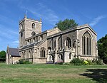
Warsop Vale
Mansfield DistrictThe DukeriesUse British English from January 2021Villages in Nottinghamshire

Warsop Vale is a small village in the Mansfield district of western Nottinghamshire, England. It is 120 miles (190 km) north west of London, 17+1⁄2 miles (28.2 km) north of the county town and city of Nottingham, and 4+1⁄4 miles (6.8 km) north of the town of Mansfield. It is in the civil parish of Warsop. Warsop Vale's heritage is primarily as a former mining village. It lies in the very picturesque area known as the Dukeries and is easily accessible to Clumber Park, Thoresby Park and hall, Rufford Park and the Earl of Portland estate of Welbeck, together all part of Sherwood Forest.
Excerpt from the Wikipedia article Warsop Vale (License: CC BY-SA 3.0, Authors, Images).Warsop Vale
West Street,
Geographical coordinates (GPS) Address Nearby Places Show on map
Geographical coordinates (GPS)
| Latitude | Longitude |
|---|---|
| N 53.206 ° | E -1.181 ° |
Address
West Street
NG20 8XH , Warsop
England, United Kingdom
Open on Google Maps


