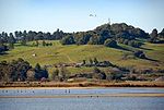
Neils Island
Islands of Northern CaliforniaIslands of Sonoma County, CaliforniaPetaluma RiverSonoma County, California geography stubs

Neils Island (sometimes called Neil Island) is a former island in Sonoma County, California, close to (and formerly surrounded by wetlands of) the Petaluma River, upstream of San Pablo Bay (an embayment of San Francisco Bay). Its coordinates are 38°11′27″N 122°34′41″W, and the United States Geological Survey measured its elevation as 82 ft (25 m) in 1981. It appears in a 1954 USGS map of the region.
Excerpt from the Wikipedia article Neils Island (License: CC BY-SA 3.0, Authors, Images).Neils Island
Geographical coordinates (GPS) Address Nearby Places Show on map
Geographical coordinates (GPS)
| Latitude | Longitude |
|---|---|
| N 38.190833333333 ° | E -122.57805555556 ° |
Address
Sonoma County (Sonoma)
California, United States
Open on Google Maps


