Kingston Russell
Civil parishes in DorsetDorset geography stubsEngvarB from February 2021Villages in DorsetWest Dorset District

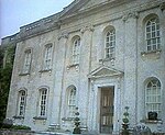
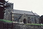
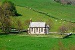
Kingston Russell is a settlement and civil parish 7 miles (11 km) west of Dorchester, in the Dorset district, in the county of Dorset, England. In 2001 the parish had a population of 35. The parish touches Compton Valence, Littlebredy, Long Bredy and Winterbourne Abbas. Kingston Russell shares a parish council with Long Bredy.
Excerpt from the Wikipedia article Kingston Russell (License: CC BY-SA 3.0, Authors, Images).Kingston Russell
Geographical coordinates (GPS) Address Nearby Places Show on map
Geographical coordinates (GPS)
| Latitude | Longitude |
|---|---|
| N 50.720385 ° | E -2.5941201 ° |
Address
DT2 9ED
England, United Kingdom
Open on Google Maps


