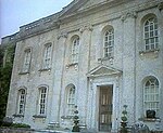
Litton Cheney

Litton Cheney is a village and civil parish in the county of Dorset in south-west England. It lies 9 miles (14 km) west of the county town Dorchester. It is sited beneath chalk hills in the valley of the small River Bride. In the 2011 census the parish had a population of 359.On Pins Knoll, to the west of the village, was once an Iron Age settlement, excavated in 1959. On the same site, in the 4th century, there was also a Romano-British building.The parish church of St Mary was substantially restored in 1878, though it retains features—notably the tower, chancel arch and parts of the nave and porch—from the 14th and 15th centuries and has a font bowl which is probably Norman; the site originated at this time or earlier.From 1953 until 1979, The Old Rectory was the home of noted English engraver, designer, typographer and painter Reynolds Stone. Litton Cheney has a small primary school 'Thorner's Church of England VA Primary School'. The school has a 'Good' OFSTED rating.
Excerpt from the Wikipedia article Litton Cheney (License: CC BY-SA 3.0, Authors, Images).Litton Cheney
Church Path,
Geographical coordinates (GPS) Address Nearby Places Show on map
Geographical coordinates (GPS)
| Latitude | Longitude |
|---|---|
| N 50.7139 ° | E -2.6358 ° |
Address
Church Path
Church Path
DT2 9AQ , Litton Cheney
England, United Kingdom
Open on Google Maps


