Döberitzer Heide
HavellandImportant Bird Areas of GermanyNature reserves in BrandenburgPotsdamProtected areas established in 1997 ... and 2 more
Special Areas of Conservation in GermanyTourist attractions in Brandenburg

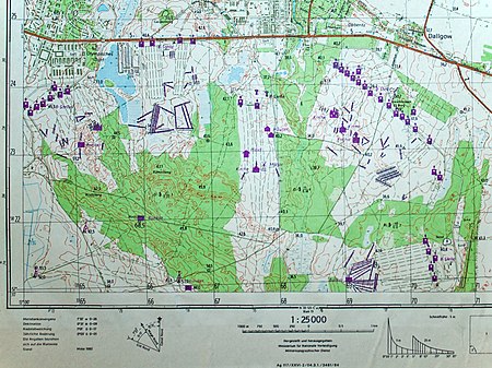
The Döberitzer Heide is an approximately 5000-hectare area in the Havelland region, part of the southeastern Nauen Plateau. The area mainly consists of the former Döberitz military training area, which has been designated as nature reserves and hosts a wilderness project by The Heinz Sielmann Foundation covering about 3600 hectares, unique in Europe. The heathland is located west of the Berlin city border and south of the Bundesstraße 5 between Dallgow-Döberitz and the district of Seeburg as well as the Wustermark districts of Elstal and Priort. A small part in the southwest lies within Potsdam territory.
Excerpt from the Wikipedia article Döberitzer Heide (License: CC BY-SA 3.0, Authors, Images).Döberitzer Heide
Geographical coordinates (GPS) Address Nearby Places Show on map
Geographical coordinates (GPS)
| Latitude | Longitude |
|---|---|
| N 52.498249680556 ° | E 13.045578003056 ° |
Address
14624
Brandenburg, Germany
Open on Google Maps


