place

Quemerford

CalneEngvarB from August 2019Villages in Wiltshire
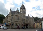
Quemerford Post Office and Stores geograph.org.uk 791034

Quemerford is a southeastern suburb of the town of Calne in the county of Wiltshire, England. It is within both the Calne and Calne Without civil parishes, and lies on the A4 road towards Marlborough, which is some 11 miles (18 km) to the east. The River Marden flows in a westerly direction to the south of Quemerford, then turns north and passes under the A4 on its way to Calne. A tributary of the Marden, the River's Brook, passes north of Quemerford.

Excerpt from the Wikipedia article Quemerford (License: CC BY-SA 3.0, Authors, Images).

Quemerford
Quemerford,

Geographical coordinates (GPS) Address Nearby Places
placeShow on map

Wikipedia: QuemerfordContinue reading on Wikipedia

Geographical coordinates (GPS)

Latitude Longitude
N 51.426 ° E -1.987 °
placeShow on map

Address

Quemerford

Quemerford
SN11 8LD , Quemerford
England, United Kingdom
mapOpen on Google Maps

Quemerford Post Office and Stores geograph.org.uk 791034
Share experience

Nearby Places

RAF Compton Bassett
RAF Compton Bassett

RAF Compton Basset was an RAF station Wiltshire, England, about 1 mile (1.6 km) east of the town of Calne.First opened as an RAF station in 1940 and used for radar training, it had no airfield. The site is often confused with RAF Yatesbury that was constructed partly within the parish of Compton Bassett in 1916. During the Second World War, RAF Yatesbury and RAF Compton Bassett were major Radio and Radar Training Schools, RAF Townsend a satellite landing ground and RAF Cherhill was No. 27 Group Headquarters Technical Training Command.After the war it became a trade training camp for certain ground Signals trades. Many thousands of newly recruited RAF personnel, most having just completed their 8 weeks basic training, were taught their RAF trade skills at RAF Compton Bassett, so as to become competent Radar Operators PPI, Wireless Operators, Teleprinter Operators, Telegraphists or Telephonists before being posted to work at RAF operational stations and airfields elsewhere in the United Kingdom or abroad. As well as their trade training, personnel experienced tougher service discipline at Compton Bassett than on operational stations. There were frequent parades involving military drill, regular "stand by your beds" inspections of personal appearance, kit inspections and inspections of barrack hut accommodation. Being put on a charge for not being up to required standard, resulting in Jankers, was very commonly experienced by personnel while being trade trained there. It also became home of the No. 3 Radio School RAF, which in the 1950s trained later washing machine entrepreneur John Bloom, The local coach company Cards of Devizes provided contracted coaches to the RAF, which on a Saturday afternoon would take the airmen to London on their 36-hour passes. Bloom decided with a friend who ran a coach company in Stoke Newington that they could underprice the Card/RAF's coaches. When Cards took Bloom to court, the judge upheld Bloom with a declaration that became Bloom's motto: "It's no sin to make a profit."

Calstone
Calstone

Calstone is a former tithing and manor in Wiltshire, England, lying southeast of Calne and adjacent to Calstone Wellington. The area was almost certainly part of the large Calne estate held by the king in the 10th century or earlier. By 1066, three estates had been granted away: one which became Calstone manor, another which became Calstone Wellington manor, and a third which was later called Blunt's. The Domesday survey in 1086 recorded three landholdings at Calestone, with altogether 62 households and four mills. The remainder, later called the 'black land' of Calstone, was kept by the Crown until 1194 when it was granted to a new owner and became the manor and parish of Blackland.Calstone village was divided between Calne and Calstone Wellington parishes. A church had been built at Calstone by 1301, presumably on the Blunt's estate; from 1600 the ecclesiastical parish was called Calstone Wellington, and the village later took this name also. Since at least 1889, the name Calstone has not been used for the settlement on Ordnance Survey maps.The Wiltshire Victoria County History lists the landowners, including the Barons Zouche from the early 14th century to the 1550s, and from 1572 Sir Lionel Duckett (1511–1587). He was a wealthy London merchant, Lord Mayor of London in 1572–1573, who supported early voyages to Africa which paved the way for the slave trade in later centuries. His son Stephen and seven other Duckett descendants were returned as MP for the rotten borough of Calne, the small number of electors being under the influence of the lord of the manor. In 1763, Thomas Duckett sold much land, including Calstone, to William Petty, 2nd Earl of Shelburne (from 1784 Marquess of Lansdowne and Viscount Calne and Calston). These lands remained part of the family's Bowood landholdings until 1954, when the Marquesses began to sell off farms, while retaining some property in the area.An estate later called Calstone Wylye was detached from Calstone manor in the 12th century, and reunited with Calstone when it was bought by Stephen Duckett in 1585.In the 19th century, Calstone Wellington was recognised as civil parish, while Calstone remained a tithing of Calne. In 1890, both Calstone Wellington and Calstone were absorbed into the newly created Calne Without parish. For the history of the church and its parish, see Calstone Wellington.

Stock, Wiltshire
Stock, Wiltshire

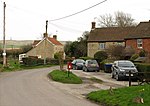
Stock is a small settlement and former ecclesiastical parish, now part of Calne Without civil parish, in the ceremonial county of Wiltshire, England. It lies about 1 mile (1.6 km) south of the town of Calne. Samuel Lewis said in A Topographical Dictionary of England (1848): STOCK, a tything, in the parish, union, and hundred of Calne, Chippenham and Calne, and N. divisions of Wilts; containing 328 inhabitants. It is situated on a tributary of the river Avon, and to the south of the road leading from Droitwich to Alcester. Stock was part of the Calne hundred, and its history is included in the parish history of Calne in the Wiltshire Victoria County History's Volume XVII (2002). Although Stock had open fields and common pastures, it did not have a nuclear settlement. Before the Norman Conquest of England and still in 1086 the land at Stock was almost certainly part of the royal estate of Calne. Land at Stockley lies to the south, and the boundary between Stock and Stockley is uncertain. Land at Stock had been granted away from Calne by 1144, although the area it then covered is unknown. Some of it was probably granted to Fulk de Cauntelo about 1199, and from 1763 on Stock was inherited with the manors of Calne and Calstone as part of the Bowood House estate. In 1728 Stock was divided between Hollow Ditch farm (now called Holly Ditch) and a farm now gone, with buildings near Quobbs Farm, on the west side of the road from Devizes to Calne (now the A3102). As part of the Bowood estate, the land of those two farms, and other land at Stock, totalling about 350 acres, was inherited by Charles Petty-Fitzmaurice, 9th Marquess of Lansdowne, in 1999.The Ordnance Survey map surveyed in 1884 shows a roadside hamlet named Stock Street near Stock Street Farm, and another named Mile Elm, further south along the road and near a farm of the same name which lies between Quobbs and Holly Ditch. Modern maps show only Mile Elm.