place

Spirthill

Hamlets in WiltshireWiltshire geography stubs
Spirthill geograph.org.uk 310161

Spirthill is a hamlet in the civil parish of Bremhill in Wiltshire, England, 2.5 miles (4.0 km) to the south of Lyneham. It is on top of a hill with views over the Avon valley and the towns of Calne and Chippenham can be seen from some points. It is a quiet community of farmland and residential housing spread out along a narrow and unlit lane. There are 19 homes in the hamlet, including five farms with livestock or arable crops. The area was once part of the nearby Bowood Estate and can trace historical links back to the 16th Century. It is believed there were farms in the area around the Domesday time or before. There are no significant industrial activities in the hamlet and development is strictly controlled by local policy. A Wesleyan Methodist chapel dated 1825 was built at Spirthill but is no longer in use.The hamlet is served by Wessex Water; Scottish and Southern Electricity are responsible for the overhead mains power supplies. The BT exchange at Hilmarton serves the hamlet via overhead telephone lines. There is no sewerage service or mains gas supply to the hamlet. There are no shops, pub or telephone box, but there is a post box. There are no regular public transport services, the nearest bus stops being on the A3102 at the foot of Snow Hill which is about 2 miles away.

Excerpt from the Wikipedia article Spirthill (License: CC BY-SA 3.0, Authors, Images).

Spirthill
Spirit Hill,

Geographical coordinates (GPS) Address Nearby Places
placeShow on map

Wikipedia: SpirthillContinue reading on Wikipedia

Geographical coordinates (GPS)

Latitude Longitude
N 51.481 ° E -2.004 °
placeShow on map

Address

Spirit Hill

Spirit Hill
SN11 9HP , Bremhill
England, United Kingdom
mapOpen on Google Maps

Spirthill geograph.org.uk 310161
Share experience

Nearby Places

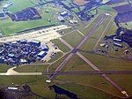
RAF Lyneham
RAF Lyneham

Royal Air Force Lyneham otherwise known as RAF Lyneham (IATA: LYE, ICAO: EGDL) was a Royal Air Force station located 6.3 miles (10.1 km) northeast of Chippenham, Wiltshire, and 10.3 miles (16.6 km) southwest of Swindon, Wiltshire, England. The station was the home of all the Lockheed C-130 Hercules transport aircraft of the Royal Air Force (RAF) before they were relocated to RAF Brize Norton. RAF Lyneham was the Royal Air Force's principal transport hub, operating the modern Lockheed Martin C-130J Hercules, and the ageing, but very adaptable, Lockheed C-130K Hercules. The airfield was designated as a Master Diversion Airfield: it was one of the primary airfields to which aircraft could divert in the eventuality of their home bases being closed due to weather, or other unforeseen events such as aircraft crashes. The airfield became renowned for being the "gateway" between the United Kingdom and Afghanistan; the station was also where repatriation of British personnel killed in Iraq and Afghanistan took place. The bodies were transported through the nearby town of Royal Wootton Bassett, with crowds lining the streets to pay tribute to the fallen. The station closed on 31 December 2012 with the majority of its personnel and other assets having moved to RAF Brize Norton. On 31 May 2011, a parade was held, attended by the Princess Royal, to mark the departure of the squadrons. The final Hercules left Lyneham on 1 July 2011. Daily flying operations ceased on 30 September 2011.The site is now known as Ministry of Defence Lyneham (or MoD Lyneham) and is home to the Defence School of Electro-Mechanical Engineering (DSEME).