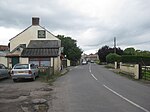
Westhay Moor

Westhay Moor (sometimes, historically, referred to as West Hay Moor) is a 513.7-hectare (1,269-acre) biological Site of Special Scientific Interest 2.5 kilometres (1.6 mi) north-east of Westhay village and 4 kilometres (2.5 mi) from Wedmore in Somerset, England, notified in 1971. Westhay Moor is also notified as part of the Somerset Levels and Moors Special Protection Area under the EU Birds Directive and as a Ramsar site, and a National Nature Reserve.The low-lying swampy area of Westhay Moor has had peat laid down over older rocks for the last 10,000 years. The Neolithic people lived on the areas of slightly higher ground but exploited the reed beds for materials and built wooden trackways to cross the raised bog. Peat extraction on the Somerset Levels has occurred since the area was first drained by the Romans. Measures to improve the drainage were carried out in the Middle Ages largely by Glastonbury Abbey. In the 17th and 18th centuries further drainage work was undertaken including digging a series of rhynes, or ditches and larger drainage canals. Peat extraction peaked in the 1960s but has since declined. The geology of the moor and prolonged peat extraction has provided a unique environment which provides a habitat for a range of flora and fauna. Much of the nature reserve managed by the Somerset Wildlife Trust is based around abandoned peatworkings which have now become flooded. It is particularly noted for the millions of starlings which roost at the site in winter.
Excerpt from the Wikipedia article Westhay Moor (License: CC BY-SA 3.0, Authors, Images).Westhay Moor
London Drove,
Geographical coordinates (GPS) Address Nearby Places Show on map
Geographical coordinates (GPS)
| Latitude | Longitude |
|---|---|
| N 51.1971 ° | E -2.78136 ° |
Address
North Hide
London Drove
BS28 4US , Meare
England, United Kingdom
Open on Google Maps


