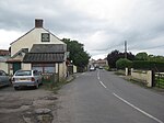
Galton's Canal
1822 establishments in EnglandCanals in SomersetCanals opened in 1822Geographic coordinate listsHistory of Somerset ... and 3 more
Industrial archaeological sites in SomersetLists of coordinatesUse British English from January 2017

Galton's Canal was a 1-mile 3 furlong (2.2 km) canal with one lock, crossing Westhay Moor in Somerset, England, and connecting the River Brue to the North Drain. It was operational by 1822, and ceased to be used after the 1850s.
Excerpt from the Wikipedia article Galton's Canal (License: CC BY-SA 3.0, Authors, Images).Galton's Canal
Parson's Drove,
Geographical coordinates (GPS) Address Nearby Places Show on map
Geographical coordinates (GPS)
| Latitude | Longitude |
|---|---|
| N 51.1985 ° | E -2.7896 ° |
Address
Parson's Drove
Parson's Drove
BS28 4TY , Godney
England, United Kingdom
Open on Google Maps


