place

Colne Bridge Mill

1818 in EnglandBuilding and structure fires in EnglandBuilding collapses caused by fireBuilding collapses in the United KingdomDisasters in Yorkshire
Factory firesFebruary 1818 eventsHuddersfieldUse British English from December 2020

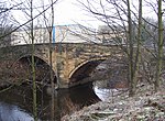
Colne Bridge Mill (English: ) was a factory, built in 1775, in the village of Colne Bridge near Bradley and Kirkheaton, Huddersfield, West Yorkshire, England, which was destroyed by fire on 14 February 1818. It was owned by the wealthy manufacturer Thomas Atkinson (1779–1838), who was also proprietor of another business at Bradley Mills, Huddersfield.

Excerpt from the Wikipedia article Colne Bridge Mill (License: CC BY-SA 3.0, Authors).

Colne Bridge Mill
Colne Bridge Road, Kirklees Bradley

Geographical coordinates (GPS) Address Nearby Places
placeShow on map

Wikipedia: Colne Bridge MillContinue reading on Wikipedia

Geographical coordinates (GPS)

Latitude Longitude
N 53.678888888889 ° E -1.7333333333333 °
placeShow on map

Address

Colne Bridge Road
HD5 0RH Kirklees, Bradley
England, United Kingdom
mapOpen on Google Maps

Share experience

Nearby Places

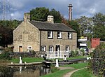
Huddersfield Broad Canal

The Huddersfield Broad Canal or Sir John Ramsden's Canal, is a wide-locked navigable canal in West Yorkshire in northern England. The waterway is 3.75 miles (6 km) long and has 9 wide locks. It follows the valley of the River Colne and connects the Calder and Hebble Navigation at Cooper Bridge junction with the Huddersfield Narrow Canal near Aspley Basin in Huddersfield. Construction was authorised in 1774, and the canal opened two years later. It became part of a trans-Pennine route in 1811 when the Huddersfield Narrow Canal joined it at Aspley Basin. Traffic was hampered by the long narrowboats used on the narrow canal that could not use Ramsden's Canal's shorter locks. Goods were transhipped at Aspley Basin, and although shorter narrowboats were built, its success as a trans-Pennine route was overshadowed by the Rochdale Canal which had wide locks throughout and joined the Calder and Hebble Navigation at Sowerby Bridge. The canal passed into railway ownership in 1845, but prospered into the 20th century. Railway ownership ceased in 1945, when it was bought by the Calder and Hebble Navigation, at which point the narrow canal across the Pennines was abandoned. The broad canal carried commercial traffic, particularly coal for power stations, until 1953. After the formation of British Waterways in 1962, the canal was designated a cruiseway in 1968, which meant that it was mainly for leisure traffic. Use of the canal has increased significantly since the Huddersfield Narrow Canal re-opened in 2001, as it is no longer a dead end. Many of its structures have been given listed building status, in recognition of their historic importance.

Bradley, Huddersfield

Bradley is a district of Huddersfield, West Yorkshire, England, 3 miles north-east of the town centre. It is generally just off the A62 Leeds Road and west of the River Colne and the Huddersfield Broad Canal. Located north of Deighton and east of Brackenhall (via Bradley bar), the area has two primary schools, a secondary school and three churches, (one Catholic, one Protestant and another converted to a gymnasium). All Saints' Catholic College, previously All Saints' Catholic High School (which serves the towns of Brighouse and the Huddersfield) is situated in the district. Built in 1960 and formerly two schools, (St Gregory's R.C. Grammar and St. Augustine's R.C. Secondary Modern) the two were combined in 1973 to form the currently large high school. Bradley has a council estate with the Keldregate thoroughfare running parallel to Leeds Road (A62), as well as two private developments which effectively constitute villages in themselves. It has many Robin Hood references in the area, including 'Sherwood Avenue', 'Huntingdon Avenue' and a former pub site called the 'Little John'. The area used to be part of a larger Bradley estate known as 'West Bradley' in comparison to 'East Bradley' which included most of Deighton and a part of Leeds Road. Has the Campaign for Real Ale (CAMRA) award-winning White Cross Inn public house on Bradley Road. Bradley Park is a 17-acre sports and recreation ground adjacent to Wilton Avenue. In December 2017 ownership of Bradley Park transferred from Kirklees Council to Friends of Bradley Park as part of a community asset transfer. Friends of Bradley Park is a registered charity that was set up for the purpose of owning, running and developing Bradley Park for the benefit of the local community. In the area there is also the 18-hole Bradley Park municipal golf course. There are 2 pubs in the area, the High Park (on Bradley Road) and the White Cross (at the intersection of Bradley Road and Leeds Road). The Woodman Inn (on Leeds Road) has been demolished as has the Badger (on Bradley Road) and the Little John (on Keldregate). Bradley was served by Bradley railway station which was closed in 1952, it was situated on Station Road which joined Leeds Road near the Woodman Inn. Bradley Viaduct is a 15 arch rail bridge crossing the Huddersfield Broad Canal and River Colne now converted to a cycleway.The school TV series How We Used To Live used Bradley as the name for a whole town, clearly located in West Yorkshire.

Kirklees Priory
Kirklees Priory

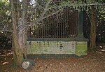
Kirklees Priory was a Cistercian nunnery whose site is in the present-day Kirklees Park, Clifton near Brighouse, Calderdale, West Yorkshire, England. It was originally in the ancient ecclesiastical parish of Dewsbury. The priory dedicated to the Virgin Mary and St James was founded by Reiner le Fleming, Lord of the manor of Wath upon Dearne, in 1155 during the reign of Henry II.The priory gives its name to the Kirklees metropolitan district council, formed in 1974 and including the towns of Huddersfield, Dewsbury and Batley, though the priory is just outside the district's boundary itself and is in neighbouring Calderdale. Nuns from the priory were involved in scandals between 1306 and 1315. Archbishop of York William Greenfield wrote to the prioress about rumours concerning Alice Raggid, Elizabeth Hopton, and Joan Heton. Rumours implied they had been seeing religious and secular men in the nunnery and their behaviour led to the house being considered one of disrepute.The priory was not dissolved by the Dissolution of the Lesser Monasteries Act in 1535, but continued for worship and hospitality. Cecilia Topcliffe was the prioress, and the convent consisted of the nuns who had been there on 4 February 1536, who continued as before the passing of the Act. In 1539, after the Second Act of Dissolution, Joan Kyppes surrendered the priory, which had eight inmates. At the date of surrender the whole property was worth £29 18s. 9d. The site was granted to John Tasburgh and Nicholas Savill; the church and priory buildings were demolished, and the stone was used to build Low Hall, now known as Old Farm.A local inn, The Three Nuns, was named after Cecilia Topclife, Joan Leverthorpe and Katherine Grace, who sought refuge at the site of a guesthouse of the priory and ran it as a hostelry. The present inn was built in 1939 and the site of the guest house is buried under the car park.All that remains of Kirklees Priory are the long double-aisled barn, and parts of the Old Farm House, calf house and the gatehouse; all are still standing as Old Farm. They are all Grade I listed buildings. The gatehouse was on Historic England's Heritage at Risk Register, but following extensive repair work was removed from the list.The landscaping of Kirklees Park was surveyed by the landscape gardener, Francis Richardson, in 1757. It contains a collection of medieval buildings preserved by the Armytage family since the 16th century.The priory is connected with the medieval legend of Robin Hood. A monument in the woods near the River Calder claims to be Robin Hood's Grave.