place

Fyfield Down

Hills of WiltshireSites of Special Scientific Interest in WiltshireSites of Special Scientific Interest notified in 1951
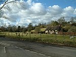
Sarsen stones, Fyfield Down geograph.org.uk 412186

Fyfield Down (grid reference SU136709) is part of the Marlborough Downs, about 1.5 miles (2.4 km) north of the village of Fyfield, Wiltshire. The down is a 325.3 hectare biological and geological Site of Special Scientific Interest, notified in 1951. The down has the best assemblage of sarsen stones in England, known as the Grey Wethers. The site is to be distinguished from another Fyfield Down also in Wiltshire, east of Pewsey and on the edge of Salisbury Plain, near another place called Fyfield. The two places are only about 9 miles (14 km) apart.

Excerpt from the Wikipedia article Fyfield Down (License: CC BY-SA 3.0, Authors, Images).

Fyfield Down
Herepath,

Geographical coordinates (GPS) Address Nearby Places
placeShow on map

Wikipedia: Fyfield DownContinue reading on Wikipedia

Geographical coordinates (GPS)

Latitude Longitude
N 51.4369 ° E -1.8057 °
placeShow on map

Address

Herepath (Green Street)

Herepath
SN8 1RU , Fyfield
England, United Kingdom
mapOpen on Google Maps

Sarsen stones, Fyfield Down geograph.org.uk 412186
Share experience

Nearby Places

The Sanctuary
The Sanctuary

The Sanctuary was a stone and timber circle near the village of Avebury in the south-western English county of Wiltshire. Excavation has revealed the location of the 58 stone sockets and 62 post-holes. The ring was part of a tradition of stone circle construction that spread throughout much of Britain, Ireland, and Brittany during the Late Neolithic and Early Bronze Age, over a period between 3300 and 900 BCE. The purpose of such monuments is unknown, although archaeologists speculate that the stones represented supernatural entities for the circle's builders. The Sanctuary was erected on Overton Hill, overlooking older Early Neolithic sites like West Kennet Long Barrow and East Kennet Long Barrow. It was connected to the Late Neolithic henge and stone circle at Avebury via the West Kennet Avenue of stones. It also lies close to the route of the prehistoric Ridgeway and near several Bronze Age barrows. In the early 18th century, the site was recorded by the antiquarian William Stukeley although the stones were destroyed by local farmers in the 1720s. The Sanctuary underwent archaeological excavation by Maud and Ben Cunnington in 1930, after which the location of the prehistoric posts was marked out by concrete posts. Now a scheduled monument under the guardianship of English Heritage, it is classified as part of the "Stonehenge, Avebury and Associated Sites" UNESCO World Heritage Site and is open without charge to visitors all year round.

Falkner's Circle
Falkner's Circle

Falkner's Circle was a stone circle near the village of Avebury in the south-western English county of Wiltshire. Built from twelve sarsen megaliths, it measured about 37 metres (121 ft) in diameter, although only one of these stones remains standing. The ring was part of a tradition of stone circle construction that spread throughout much of Britain, Ireland, and Brittany during the Late Neolithic and Early Bronze Age, over a period between 3300 and 900 BCE. The purpose of such monuments is unknown, although archaeologists speculate that the stones represented supernatural entities for the circle's builders. Positioned in a dry valley, the circle was erected on the southern end of a field that contained a range of natural sarsens. It is possible that the megaliths were erected very close to where they were naturally found. The site had previously seen human activity in the Mesolithic period and may have been symbolically meaningful for local communities for a long time before the circle was created. The ring was located close to other Late Neolithic and Early Bronze Age monuments, such as the West Kennet Avenue and Avebury stone circle, although its precise relationship to these is unclear. Extensive flint knapping took place at the site during the Late Neolithic or Early Bronze Age. Archaeological evidence indicates that in the Iron Age, a hearth was placed on the site, and in the post-medieval period a number of the stones were toppled and destroyed through burning. Most of the stones in the circle were lying prone on the ground by the seventeenth century, which might explain why it was left undiscovered by antiquarians exploring the area in that period, like John Aubrey and William Stukeley. The earliest known report of the site came from a Mr Falkner, who discovered it in 1840 while riding in the area. Due to the intensification of agriculture, all the prone stones were removed—thus destroying the circle—in either the late nineteenth or twentieth century. The site was excavated in 2002 in an archaeological project led by Mark Gillings and Joshua Pollard.