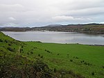
Craobh Haven
Craobh Haven Scottish Gaelic pronunciation: [kɾɯːv] is a small purpose-built village and sailing port on the west coast of Argyll and Bute, Scotland. It is situated on the Craignish peninsula, 1 mile (1.6 km) to the west of the A816 road, approximately 22 miles (35 km) south of Oban. Craobh Haven is between Arduaine and Kilmartin, and around 17 miles (27 km) north of Lochgilphead. Craobh Haven was built in 1983 as a holiday resort village and marina. Glasgow-based architects Gillespie, Kidd & Coia were involved in the early stages of the project, but were replaced before the construction of the buildings. The large, safe water marina was formed by the building of causeways and a large breakwater between a small group of tidal saltwater islands. The village has one public house, called "The Lord of The Isles", a village store, as well as a harbourmaster and marina office. A watersports centre, together with holiday accommodation, is located on Eilean Buidhe, one of the small islands surrounding the marina. Within the village, there are two small terraces of houses, a group of small cottages, the majority of which are used as holiday rentals, and several small cottages and larger houses scattered around the outer edges and the hillside above the village. The enclosed marina is very popular with private boat owners, but does not have anchorage for larger passenger vessels. There are occasional visits to the village by small cruise ships, touring the nearby islands, which land passengers by their ships boats to awaiting coaches, for sight-seeing trips ashore. The waters to the north of Craobh Haven are part of the Firth of Lorne, and the village overlooks the Slate Islands, with Shuna being the closest. Beyond the Slate Islands are the Garvellachs, and to the southwest are the islands of Colonsay, Oronsay, Jura and Islay.
Excerpt from the Wikipedia article Craobh Haven (License: CC BY-SA 3.0, Authors).Craobh Haven
Geographical coordinates (GPS) Address Phone number Nearby Places Show on map
Geographical coordinates (GPS)
| Latitude | Longitude |
|---|---|
| N 56.211096 ° | E -5.557709 ° |
Address
Brauhaus am Kreuzberg (Friedels Keller)
1
91352
Bayern, Deutschland
Open on Google Maps


