place

Westfield Topanga

1964 establishments in CaliforniaCanoga Park, Los AngelesShopping malls established in 1964Shopping malls in Los AngelesShopping malls in the San Fernando Valley
Use mdy dates from October 2020Westfield GroupWoodland Hills, Los Angeles
Westfield Topanga logo

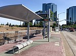
Westfield Topanga is a shopping mall in the Canoga Park neighborhood of Los Angeles, California. It has 1,588,050 square feet (147,535 m2) of gross leasable area and features Nordstrom, Macy's, Neiman Marcus, and Target. The mall has been owned by Westfield-affiliated companies since 1993, and has been owned by the present-day Unibail-Rodamco-Westfield since 2017.

Excerpt from the Wikipedia article Westfield Topanga (License: CC BY-SA 3.0, Authors, Images).

Westfield Topanga
Canyon Creek Drive, Los Angeles Warner Center

Geographical coordinates (GPS) Address Website External links Nearby Places
placeShow on map

Wikipedia: Westfield TopangaContinue reading on Wikipedia

Geographical coordinates (GPS)

Latitude Longitude
N 34.190277777778 ° E -118.60361111111 °
placeShow on map

Address

Westfield Topanga

Canyon Creek Drive
91367 Los Angeles, Warner Center
California, United States
mapOpen on Google Maps

Website
westfield.com

linkVisit website

linkWikiData (Q7988760)
linkOpenStreetMap (5973981)

Westfield Topanga logo
Share experience

Nearby Places

Bell Creek (Southern California)

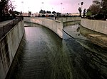
Bell Creek (also known as Escorpión Creek) is a 10-mile-long (16 km) tributary of the Los Angeles River, in the Simi Hills of Ventura County and the San Fernando Valley of Los Angeles County and City, in Southern California. The confluence marks the "headwaters" of the Los Angeles River, 34.1952°N 118.601838°W / 34.1952; -118.601838.t) and Bell Creek (right) join to form the Los Angeles River. The initial headwater feeder-streams begin in the Simi Hills in Ventura County from 90% of the Rocketdyne Santa Susana Field Laboratory (SSFL) property as its watershed, leaving the site with toxic substances and radionuclide contamination via culvert outfalls, aquifer seeps and springs, and surface runoff. It then flows as a creek southeast through Bell Canyon (the community and geographic feature), Bell Canyon Park, and El Escorpión Park in a natural stream bed. It then is altered to flow in a concrete channel. Moore Creek joins in from the west, and then it flows east, channelized through West Hills, where it is joined by the South Fork and South Branches of the same name and by Dayton Creek. Then on through Canoga Park to join Arroyo Calabasas (Calabasas Creek) and becoming the Los Angeles River. Bell Creek begins as a free-flowing stream until passing Escorpión Peak (Castle Peak) in Bell Canyon Park. At Bell Canyon Road and Elmsbury Lane it becomes encased in a concrete flood control channel. It then passes under Valley Circle Boulevard, flowing just south of Highlander Road through former Rancho El Escorpión-current West Hills, and further eastward parallel to (and south of) Sherman Way in Canoga Park. There, it joins Arroyo Calabasas, directly east of Canoga Park High School beside Vanowen Street. The confluence marks the "headwaters" of the Los Angeles River, 34.1952°N 118.601838°W / 34.1952; -118.601838.