place

Totley Moor

Moorlands of EnglandMountains and hills of DerbyshireMountains and hills of the Peak DistrictUse British English from March 2020
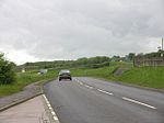
Post on Totley Moor geograph.org.uk 260975

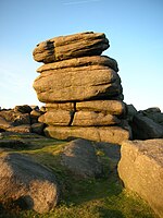
Totley Moor is an open moorland hill to the west of the Sheffield suburb of Totley, in the Derbyshire Peak District. The summit is 395 metres (1,296 ft) above sea level.Totley Tunnel runs for 3.5 miles (5.6 km) under Totley Moor and Longshaw Estate, between Totley and Grindleford stations. It was built between 1888 and 1893 by Midland Railway for the route between Sheffield and Manchester through the Hope Valley. A large air ventilation shaft rises from a natural cavern, which the tunnel passes through, up to the surface on Totley Moor. The tunnel remains in use today for frequent trans-pennine passenger trains.Bar Brook stream drains the marshy Totley Moss area, running south to feed the disused Bar Brook Reservoir. It then continues to flow south and into the River Derwent by Chatsworth Park.On the north-eastern side of Totley Moor, Blacka Moor Nature Reserve is managed by Sheffield & Rotherham Wildlife Trust. The reserve covers 181 hectares and is part of the Eastern Peak District Moors SSSI (Site of Special Scientific Interest). The open moor is a landscape of purple moor-grass, heathers and bilberry. It provides a moorland habitat for willow warblers, black caps, cuckoos, wheatears, stonechats and whinchats. Red deer are also a common sight.There are three Bronze Age cairnfields along Brown Edge ridge which are protected Scheduled Monuments. An excavation in 1963 of the site of a 7m wide ring cairn discovered cremation remains, urns, a pygmy cup and a hearth. The artefacts are on display in Weston Park Museum, Sheffield. In 1960, following fires on the moor, a Bronze Age shale-working floor was discovered at Flask Edge with shale fragments of bracelets and rings.Following the Countryside and Rights of Way Act 2000, this gritstone upland moor became "Open Access" land for the public. The Sheffield Country Walk bridlepath runs across the moor between Totley and the A6187 road. The Peak District Boundary Walk crosses the eastern side of Totley Moor, running through Blacka Moor Nature Reserve and above Brown Edge, just below the summit.

Excerpt from the Wikipedia article Totley Moor (License: CC BY-SA 3.0, Authors, Images).

Totley Moor
Hathersage Road, Sheffield

Geographical coordinates (GPS) Address Nearby Places
placeShow on map

Wikipedia: Totley MoorContinue reading on Wikipedia

Geographical coordinates (GPS)

Latitude Longitude
N 53.316 ° E -1.584 °
placeShow on map

Address

Hathersage Road
S11 7TW Sheffield
England, United Kingdom
mapOpen on Google Maps

Post on Totley Moor geograph.org.uk 260975
Share experience

Nearby Places

Hathersage Road (Sheffield)

Hathersage Road is a road in Sheffield South Yorkshire, England and Derbyshire. It leads south-west from the suburb of Whirlow over the border between Hathersage and Sheffield, before becoming Sheffield Road at the point called Surprise View. The road begins at a bridge on the Limb Brook, the former boundary between Yorkshire and Derbyshire. There the road changes name from Ecclesall Road South to Hathersage Road. The road passes Whirlow Woods and Whirlow Hall Farm, the Dore Moor Inn, Fox House hotel at the top of Padley Gorge, crosses the Burbage Brook and ends at a tight curve at Surprise View, from where there are views of Hope Valley. The junction with Cross Lane and Long Line is deemed dangerous and a speed camera was installed. According to the Sheffield antiquarian, Sidney Oldall Addy, a feature known as the Giant's Chair could be found close to the road, near the junction of Whitelow Lane. No sign of this feature appears on modern maps, although it is shown on an 1888 map in Addy's A glossary of words used in the neighbourhood of Sheffield.Blacka Moor Nature Reserve, managed by the Wildlife Trust for Sheffield and Rotherham is located close to the intersection of the A625 and A6187. The 181 hectares (450 acres) reserve is the largest of the nature reserves managed by the trust, and has a migrant bird population which includes willow warblers, blackcaps, common cuckoos, northern wheatears, European stonechats and whinchats. Near Fox House, the road bends tightly whilst passing over Padley Gorge and is overshadowed by Toad's Mouth; a stone hanging over the road not dissimilar to the shape of a toad. This feature marks the boundary between Sheffield and Derbyshire. The road forms part of the A625. Until 2000, the entire course of Hathersage Road was numbered A625. Hathersage Road is now only numbered A625 as far as the junction with Stony Ridge Road where the A625 proceeds towards Calver. Between Hathersage and Stony Ridge Road junction, Hathersage Road is numbered A6187. A section of the A625 was severed in 1979 due to a landslip at Mam Tor hence the re-designation of the road number for part of the route.

Longshaw Estate
Longshaw Estate

Longshaw Estate is an area of moorland, woodland and farmland located within the Peak District National Park, Derbyshire, England. The name of Longshaw is thought to have derived from the long wood in Padley Gorge. There are remains from Bronze Age and medieval human settlement in the area. Millstones were made from the gritstone at Yarncliffe Quarry back to the 15th-century. There are two guidestoops (stone guide posts) from the early 1700s on the estate, required by an Act of Parliament to help travellers across open moorland. The Duke of Rutland acquired the estate in 1855. He built Longshaw Lodge for shooting parties at the estate. The Longshaw Sheepdog Trials have been held since 1898 and are supposed to be the oldest to be run every year in England. The duke sold the estate in 1927 to Sheffield Corporation.In 1928 Ethel Haythornthwaite spearheaded an urgent appeal to the Yorkshire public, which helped Peak District and South Yorkshire CPRE to raise the funds to buy the 747-acre Longshaw Estate, which was threatened with development. The estate was given to the National Trust in 1931.The estate is part of the larger National Trust Peak District Estate and is run along with the High Peak Estate and White Peak Estate. At Longshaw, there is a tea room, shop and a learning facility called the Moorland Discovery Centre, which is a joint venture between the National Trust and the Peak National Park. Also staff and volunteers run many events throughout the year on the estate relating to wildlife, the estate itself and many other topics.

Burbage Rocks
Burbage Rocks

Burbage Rocks is a gritstone escarpment in South Yorkshire, overlooking the village of Hathersage in the Peak District. The highest point along the escarpment is 429 metres (1,407 ft) above sea level, whilst Burbage Moor rises above to 438 metres (1,437 ft). Burbage Rocks is a southern extension of Stanage Edge. Burbage Brook runs from the northern end of the Burbage Rocks, past the southern end, through Padley Gorge and into the RIver Derwent.The gritstone edge of Burbage Rocks is a popular rock climbing location. The Burbage Rocks North area is close to a car park and has 481 graded routes including many short, easy routes. The quieter Burbage South Edge area has 289 graded routes with much more challenging, long buttress climbs. Burbage South Quarries has a further 108 graded routes. The following routes on Burbage South Edge were climbed in the 1998 rock-climbing film Hard Grit: Samson (E8 7b) climbed by Jerry Moffatt Braille Trail (E7 6c) climbed by Dave Jones Parthian Shot (E9 7a) climbed by Seb Grieve Below Burbage Rocks (on Hathersage Moor to the west) are the hill Higger Tor and Carl Wark, the rocky platform of an Iron Age hillfort, which is a scheduled monument.Sheffield Country Walk is a 86 kilometres (53 mi) long trail which runs along the public footpath below the edge. Following the Countryside and Rights of Way Act 2000, the area of Burbage Rocks and surrounding moorland were designated as "Open Access" land for the public.