Southwood, Norfolk
BroadlandFormer civil parishes in NorfolkHamlets in NorfolkNorfolk geography stubs

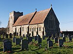
Southwood is a hamlet and former civil parish, 10 miles (16 km) east of Norwich, now in the parish of Cantley, Limpenhoe and Southwood, in the Broadland district, in the county of Norfolk, England. In 1931 the parish had a population of 40. It has a church called St Edmund which is in ruins. Southwood Hall is a post medieval great house and serves as a wedding venue.
Excerpt from the Wikipedia article Southwood, Norfolk (License: CC BY-SA 3.0, Authors, Images).Southwood, Norfolk
Oaks Farm Lane, Broadland Cantley
Geographical coordinates (GPS) Address Nearby Places Show on map
Geographical coordinates (GPS)
| Latitude | Longitude |
|---|---|
| N 52.593206 ° | E 1.5362915 ° |
Address
Oaks Farm Lane
Oaks Farm Lane
NR13 3LR Broadland, Cantley
England, United Kingdom
Open on Google Maps


