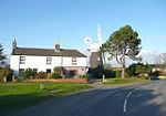
Lessingham

Lessingham is a village and a civil parish in the English county of Norfolk. The village is 16.3 south-east of Cromer, 17.6 miles north-east of Norwich and 136 miles north-east of London. The village lies 9 miles south-east of the town of North Walsham. The nearest railway station is at Worstead for the Bittern Line which runs between Sheringham, Cromer and Norwich. The nearest airport is Norwich International Airport. The parish also includes the village of Eccles-on-Sea and the hamlet of Hempstead. The village has a history stretching back for centuries, but not much documentation survives. The name Lessingham derives from the 'homestead of the Leofsige's people'
Excerpt from the Wikipedia article Lessingham (License: CC BY-SA 3.0, Authors, Images).Lessingham
Star Hill, North Norfolk Lessingham
Geographical coordinates (GPS) Address Nearby Places Show on map
Geographical coordinates (GPS)
| Latitude | Longitude |
|---|---|
| N 52.799 ° | E 1.543 ° |
Address
Star Hill
NR12 0DN North Norfolk, Lessingham
England, United Kingdom
Open on Google Maps


