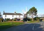
Happisburgh

Happisburgh ( ) is a village civil parish in the English county of Norfolk. The village is on the coast, to the east of a north–south road, the B1159 from Bacton on the coast to Stalham. It is a nucleated village. The nearest substantial town is North Walsham 6 miles (10 km) to the west.The place-name 'Happisburgh' is first attested in the Domesday Book of 1086, where it appears as Hapesburc. The name means 'Hæp's fort or fortified place'.Happisburgh became a site of national archaeological importance in 2010 when flint tools over 800,000 years old were unearthed. This is the oldest evidence of human occupation anywhere in the UK. In May 2013, a series of early human footprints were discovered on the beach at the site, providing direct evidence of early human activity at the site.Land in the area has been lost to the sea for thousands of years. The civil parish shrank by over 0.2 km2 (50 acres) in the 20th century by the erosion of its beaches and low cliffs. The rate of erosion is the same as it has been for the past 5,000 years. In 1968, groynes were constructed along the shore to try to slow the erosion. In the 2001 census, before the separation of Walcott parish to the north-west, the parish (which also includes the settlements of Happisburgh Common and Whimpwell Green) had a population of 1,372 in 607 households. For the purposes of local government, the parish is in the district of North Norfolk.
Excerpt from the Wikipedia article Happisburgh (License: CC BY-SA 3.0, Authors, Images).Happisburgh
The Street, North Norfolk Happisburgh
Geographical coordinates (GPS) Address Phone number Website Nearby Places Show on map
Geographical coordinates (GPS)
| Latitude | Longitude |
|---|---|
| N 52.8242 ° | E 1.5309 ° |
Address
Happisburgh Church of England Voluntary Aided Primary and Early Years School
The Street
NR12 0AB North Norfolk, Happisburgh
England, United Kingdom
Open on Google Maps


