place

Shiawassee River

Rivers of Genesee County, MichiganRivers of Livingston County, MichiganRivers of MichiganRivers of Midland County, MichiganRivers of Oakland County, Michigan
Rivers of Saginaw County, MichiganRivers of Shiawassee County, MichiganSuperfund sites in MichiganTributaries of Lake Huron
Shiawassee River 1
Shiawassee River 1

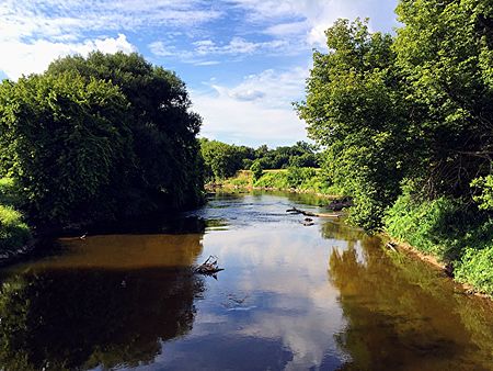
The Shiawassee River ( shy-ə-WAH-see) in the U.S. state of Michigan drains an area of 1,201 square miles (3,110 km2) within Oakland, Genesee, Livingston, Shiawassee, Midland and Saginaw counties. It flows in a generally northerly direction for approximately 110 miles (180 km) from its source to its confluence with the Tittabawassee River creating the Saginaw River, which drains into Saginaw Bay of Lake Huron.The name is derived from the Chippewa "shia-was-see" meaning "the river straight ahead."

Excerpt from the Wikipedia article Shiawassee River (License: CC BY-SA 3.0, Authors, Images).

Shiawassee River
Wickes Park Drive, Saginaw

Geographical coordinates (GPS) Address Nearby Places
placeShow on map

Wikipedia: Shiawassee RiverContinue reading on Wikipedia

Geographical coordinates (GPS)

Latitude Longitude
N 43.38697 ° E -83.96608 °
placeShow on map

Address

Wickes Park Drive
48602 Saginaw
Michigan, United States
mapOpen on Google Maps

Shiawassee River 1
Shiawassee River 1
Share experience

Nearby Places

History of Saginaw, Michigan

The history of Saginaw, Michigan explores the development of the city from the time that Native American hunter-gatherers ranged through the area. There was little settlement, though, until the 19th century when the marshes were drained to alleviate the endemic mosquito infestation. The site of what later became the city of Saginaw was originally inhabited by the Anishnabeg. French missionaries and traders first appeared in the area during the late 17th century and encountered the Ojibwe (Chippewa) living in the area. Because of convenient means of travel to the area by rivers, streams, and Lake Huron, the area was one of the sites of councils of The Three Fires: Ojibwe, Pottawatomi, and Ottawa. Henri Nouvel, a Jesuit missionary visited the area in the 17th century and recorded his travels in a journal. A trading post was established by Louis Campeau in 1816. The Treaty of Saginaw in 1819 cleared the way for settlement by white people. To control the Ojibwe in the region, the United States government established Fort Saginaw in 1822, but the mosquito infestation and humidity was so severe that the fort was closed in 1824. Campau platted a town, but few lots were sold for some time. Also in 1822, Saginaw County was established. Saginaw realized significant growth due to the lumber industry boom of the 19th century. Two cities had been established Saginaw City and East Saginaw, which were consolidated into the current city of Saginaw in March, 1890. The city grew substantially as automotive manufacturers opened plants in Saginaw and when the city answered the call to produce munitions and motor vehicle parts during World War II. African-Americans migrated from the south for manufacturing jobs and Saginaw saw a significant change in the demographics within the city, which created racial tensions that affected the political climate and opportunities for African-Americans, such as the ability to purchase houses. In the late 20th century, the city began to decline economically as the number of manufacturing jobs declined significantly and the rate of unemployment increased dramatically. More recently, economic development in the region is focused on comparative advantages in innovation, clean energy, and continued manufacturing exports.