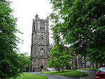
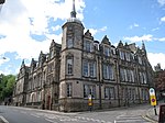
Lancaster Roman Fort

Lancaster Roman Fort, also known as Wery Wall, Galacum or Calunium, is the modern name given to ruined former Roman fort atop Castle Hill in Lancaster in North West England. The first castra was founded c. 80 AD within the Roman province of Britannia. The fort's name is not known. A Roman milestone found four miles outside Lancaster, with an inscription ending L MP IIII, meaning "from L— 4 miles", suggests that it began with that letter. However in 1998 David Shotter suggested that Galacum, a name that has been associated with the fort at Over Burrow, would be more appropriately applied to Lancaster.The fort is thought to be the origin of the name Lancaster. It appears in the Domesday Book as Loncastre, where "Lon" refers to the River Lune, with the Old English cæster (borrowed from the Latin castrum) for "fort".
Excerpt from the Wikipedia article Lancaster Roman Fort (License: CC BY-SA 3.0, Authors, Images).Lancaster Roman Fort
Damside Street, Lancaster Vale
Geographical coordinates (GPS) Address Website Nearby Places Show on map
Geographical coordinates (GPS)
| Latitude | Longitude |
|---|---|
| N 54.0515 ° | E -2.80347 ° |
Address
Roman Bath House
Damside Street
LA1 1AH Lancaster, Vale
England, United Kingdom
Open on Google Maps


