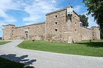
Goyer Island

L'Île Goyer is a river island of the Richelieu River. It belongs to the territory of the municipality of Carignan, in the La Vallée-du-Richelieu Regional County Municipality, in the administrative region of Montérégie, in the south of province of Quebec, in Canada. A municipal Bévédère stop, located on backfilled land, is located on the southeast side on the shore of the Bassin-de-Chambly, where civic parties are sometimes organized. Genest Park, located at the intersection of Deux-Rivières and Tulippes streets, and comprising an area of 1,786 metres (5,859.58 ft) was redeveloped in 2019. This park includes a permanent dek hockey area as well as play areas for children and pre-teens. There is also the waterfront park of Île Goyer located in the northeast part on the northwest shore of the Chambly basin.
Excerpt from the Wikipedia article Goyer Island (License: CC BY-SA 3.0, Authors, Images).Goyer Island
Rue des Jacinthes,
Geographical coordinates (GPS) Address Nearby Places Show on map
Geographical coordinates (GPS)
| Latitude | Longitude |
|---|---|
| N 45.47694 ° | E -73.28 ° |
Address
Rue des Jacinthes 2842
J3L 7G9
Quebec, Canada
Open on Google Maps


