Chambly Basin
Geographic coordinate listsLa Vallée-du-Richelieu Regional County MunicipalityLakes of MontérégieLists of coordinatesRouville Regional County Municipality

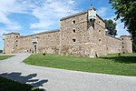
The Chambly Basin (French: bassin de Chambly) is a shallow, oblong body of water formed by an enlargement of the Richelieu River, extending out from the foot of the rapids on the river between Chambly and Richelieu, in the Quebec region of Montérégie. The towns of Chambly, Richelieu, Saint-Mathias-sur-Richelieu and Carignan surround the basin. The Chambly Basin is an important area for recreational tourism activities including boating in the summer, the connected Chambly Canal and nearby Fort Chambly National Historic Sites. Its surface is generally frozen from mid-December to the end of March. The water level of the river varies with the seasons and the precipitation.
Excerpt from the Wikipedia article Chambly Basin (License: CC BY-SA 3.0, Authors, Images).Chambly Basin
Geographical coordinates (GPS) Address Nearby Places Show on map
Geographical coordinates (GPS)
| Latitude | Longitude |
|---|---|
| N 45.461111111111 ° | E -73.283333333333 ° |
Address
Chambly
Quebec, Canada
Open on Google Maps


