Île aux Lièvres (Richelieu River)
La Vallée-du-Richelieu Regional County MunicipalityRiver islands of QuebecUse Canadian English from January 2023
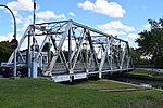
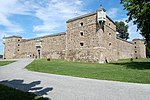
L île aux Lièvres (English: Hare Island) is a river island of the Richelieu River, in the territory of the municipality of Carignan, in the La Vallée-du-Richelieu Regional County Municipality, in the region administrative Montérégie, in the south of province of Quebec, in Canada. This island includes the municipal park of the northern tip of Île aux Lièvres, the Seigneurie park and the Chenaux park.
Excerpt from the Wikipedia article Île aux Lièvres (Richelieu River) (License: CC BY-SA 3.0, Authors).Île aux Lièvres (Richelieu River)
Rue Jeanne-Servignan,
Geographical coordinates (GPS) Address Nearby Places Show on map
Geographical coordinates (GPS)
| Latitude | Longitude |
|---|---|
| N 45.47166 ° | E -73.29278 ° |
Address
Rue Jeanne-Servignan 213
J3L 7G9
Quebec, Canada
Open on Google Maps


