place

Combs Ditch

Archaeological sites in DorsetHistory of DorsetLinear earthworksScheduled monuments in DorsetUnited Kingdom archaeology stubs

Combs Ditch is a linear earthwork in Dorset on Charlton Down. It was once at least 6.4 km long but now only 4.4 km is visible. It is sometimes spelt Comb's Ditch or Combe Ditch. The earthwork consists of a bank with a ditch on the north east side. Combs Ditch forms the boundary between several parishes in Dorset. The parishes of Charlton Marshall and Spetisbury lie to the north east of Combs Ditch while Winterborne Whitechurch, Winterborne Kingston and Anderson lie to the south west.Combs Ditch is to the north of the Roman road that ran from Badbury Ring to Dorchester but there is no evidence that it intersected the road. The bank ranges from 5.4 m to 8.5 m wide with a maximum height of 2.2 m. The ditch varies in width from 4.8 to 8.5 m. Excavation found third- or fourth-century Roman pottery lying on the turf line behind the bank probably before its final reconstruction. The limited excavation seems to show an Iron Age boundary ditch being enlarged into a defensive earthwork in the late Roman or post-Roman period. This is similar to the nearby linear earthwork of Bokerley Dyke. It is a scheduled ancient monument.

Excerpt from the Wikipedia article Combs Ditch (License: CC BY-SA 3.0, Authors).

Combs Ditch
Muston Lane,

Geographical coordinates (GPS) Address Nearby Places
placeShow on map

Wikipedia: Combs DitchContinue reading on Wikipedia

Geographical coordinates (GPS)

Latitude Longitude
N 50.80568 ° E -2.18528 °
placeShow on map

Address

tumulus

Muston Lane
DT11 9HD
England, United Kingdom
mapOpen on Google Maps

Share experience

Nearby Places

St Andrew's Church, Winterborne Tomson

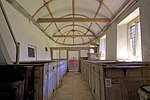
St Andrew's Church in Winterborne Tomson, Dorset, England, was built in the 12th century. It is recorded in the National Heritage List for England as a designated Grade I listed building, and is a redundant church in the care of the Churches Conservation Trust. It was declared redundant on 1 June 1972, and was vested in the Trust on 26 March 1974.The small flint and stone Norman Anglican Church of St Andrew has an apse at the east end and a barrel vault roof which curves around it. The roof was replaced and windows inserted in the 16th century. The oak door is heavily studded. The interior has limewashed walls, a 15th-century font and flag stone floor, along with early 18th-century oak fittings. The eighteenth century oak pews, the pulpit, screen, communion rails and matching table with barley sugar turned legs, and other woodwork were provided by William Wake, Archbishop of Canterbury, who had been raised in the village of Shapwick and whose family lived locally. The west end has a late medieval gallery with a panelled front which was probably originally a rood screen. The roof is topped by a small weatherboard belfry which resembles a dovecote.By the early 20th century, the church had fallen into disrepair and was being used as an animal shelter by a local farmer. Repairs were paid for by the Society for the Protection of Ancient Buildings who sold a collection of Thomas Hardy’s manuscripts to raise the funding. The work was supervised by A. R. Powys who also oversaw the work at the Old St Cuthbert's Church, Oborne.

Blandford St Mary
Blandford St Mary

Blandford St Mary is a village and civil parish in the North Dorset district of Dorset, England. The village is on the south bank of the River Stour, immediately opposite the larger town of Blandford Forum. The village grew up around the Badger Brewery, owned by Hall and Woodhouse, which is based there. At the 2001 census it had a population of 1,233. The appropriate electoral ward is called 'Portman' with naturally the most populous area being south of the river. The ward includes Bryanston School and also runs south west almost to Thornicombe. The total ward population at the abovementioned census was 2,436.Blandford St Mary has a busy Tesco supermarket and fuel station and a Homebase DIY store which attracts shoppers from the many villages that surround the Blandford area. In addition there are a number of offices in Stour Park. In the residential area there is a new housing estate and primary school. An older area of the village near the river bridge to Blandford Forum has a traditional public house and a village green. Opposite is the old stone gate at the entrance of the Bryanston School estate. Outline planning permission has been given to redevelop the Hall & Woodhouse brewery site to include new offices and 200 new homes. Lower Blandford St Mary is a rural outpost of Blandford St Mary, in the farm fields to the south across the bypass road, with a small church and graveyard, and one or two historic houses. The Dorset Central Railway, which opened on 1 November 1860 from the LSWR station at Wimborne, had a station in the village, serving the neighbouring important market town of Blandford Forum. This was demolished when the line amalgamated to be part of the Somerset & Dorset Railway, and a bridge was built over the river Stour to the station at Blandford.

Winterborne Clenston

Winterborne Clenston is a small village and civil parish in Dorset, England, around 3+1⁄2 miles (5.5 kilometres) southwest of Blandford Forum. In 2013 the civil parish had an estimated population of 40.The first part of the village name comes from the River Winterborne, which flows from north to south through the village. The river only flows overground during the winter, hence the name. In 1312 the patron of the church was Roger de Clencheston, who most likely had a farm here, after which the second part of the village name derives.To the north of the village is Winterborne Stickland and to the south is Winterborne Whitechurch. The river flows through both these villages as well.The parish church of St Nicholas dates from 1840. It is built in bands of stone and flint and has a spire on top of a narrow tower. It stands alone above the Winterborne on the site of an earlier church.The village manor is a late-15th- to early-16th-century building of Purbeck and Portland stone with courses of flint. It was built in the sixteenth and seventeenth centuries and is a Grade I listed building. It has mullioned windows and a gabled staircase turret on the west side. Nearby is a sixteenth-century tithe-barn with a hammerbeam roof, also a listed building but falling into disrepair. In 2008, Historic England funded the erection of scaffolding and temporary repairs to the structure, but by 2016, a permanent repair had not been made.About 100 metres (300 feet) east of the manor house is a field barn which is also a Grade II listed building. It is also built in bands of flint and stone and has a door made of planks and a thatched roof. It forms an important group with the Manor House and the Manor House Barn.